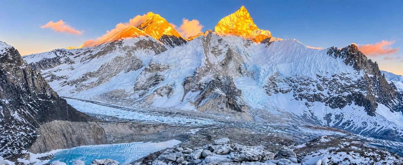

Mount Everest is the highest mountain on Earth. Its summit stands 8,848.86 metres (29,032 ft) above sea level, right on the border between Nepal and the Tibet Autonomous Region of China. Nepalis call it Sagarmatha, Tibetans call it Chomolungma, and the Sherpa people who live below it treat it as the home of a goddess.
Edmund Hillary and Tenzing Norgay first reached the top on 29 May 1953. By the end of 2025, more than 7,500 different people had stood on the summit. The mountain has also claimed more than 340 lives, which is why the full story of Everest includes its weather, its geology and the Sherpa climbers who make most expeditions possible.
This guide answers the questions travellers and students ask most often, using the latest survey data, Himalayan Database statistics and the results of the record-breaking spring 2026 season.
Mount Everest at a glance
|
Fact |
Detail |
|
Height |
8,848.86 m (29,032 ft), announced by Nepal and China on 8 December 2020 |
|
Location |
Mahalangur Himal range of the Himalayas, on the Nepal and Tibet (China) border |
|
Nepal side |
Khumbu region, Solukhumbu District, Koshi Province, inside Sagarmatha National Park |
|
Tibet side |
Tingri County, Shigatse, inside the Qomolangma National Nature Preserve |
|
Local names |
Sagarmatha (Nepali), Chomolungma or Qomolangma (Tibetan) |
|
First ascent |
29 May 1953, Edmund Hillary and Tenzing Norgay, via the South Col |
|
Main climbing routes |
South Col and Southeast Ridge (Nepal); North Col and Northeast Ridge (Tibet) |
|
Main climbing season |
April to early June, with most summits in mid to late May |
|
Total summits to end of 2025 |
13,737 summits by 7,563 people |
|
Recorded deaths to end of 2025 |
339, with five more in spring 2026 |
|
Most summits by one person |
32, Kami Rita Sherpa (latest on 17 May 2026) |
|
Protected area |
Sagarmatha National Park, established 1976, UNESCO World Heritage Site since 1979 |
What Is Mount Everest? Location, Height, and Names
Mount Everest is the highest point on Earth's surface, a three-sided pyramid of rock and ice in the Mahalangur Himal section of the Himalayas.
Where is Mount Everest located?
Mount Everest sits on the border between Nepal and China, and the international boundary runs directly across its summit. The southern side lies in Nepal's Khumbu region, in Solukhumbu District, Koshi Province. The northern side lies in Tingri County in the Tibet Autonomous Region of China.
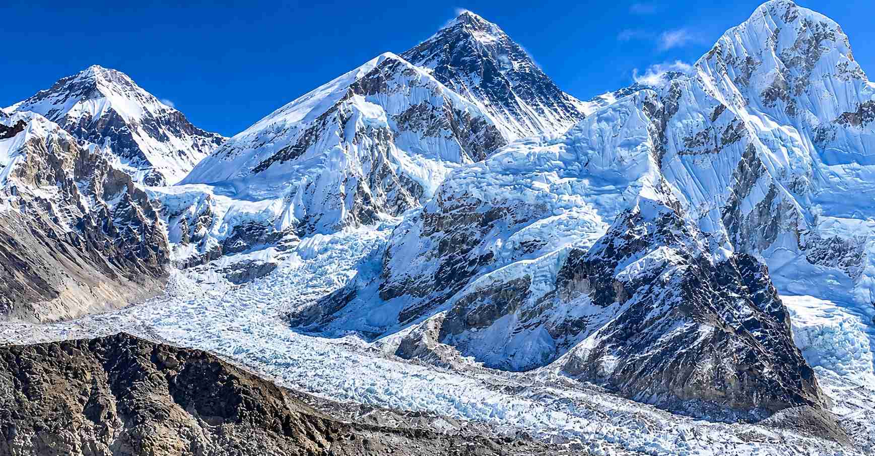
On the Nepal side, the mountain is protected inside Sagarmatha National Park, about 160 km east-northeast of Kathmandu as the crow flies. Its closest neighbours are Lhotse (8,516 m), joined to Everest by a high saddle called the South Col, and Nuptse (7,861 m). Nuptse is so close that it hides most of Everest's summit from Everest Base Camp.
How high is Mount Everest?
The official Mount Everest height is 8,848.86 metres (29,032 ft). Nepal and China announced this figure together on 8 December 2020, after Nepali surveyors measured from the summit in 2019 and a Chinese team did the same in 2020.
The number has changed several times as tools improved:
|
Survey |
Height given |
|
Great Trigonometrical Survey of India (announced 1856) |
29,002 ft (about 8,840 m) |
|
Survey of India (mid-1950s) |
8,848 m |
|
China (2005, rock height without the snow cap) |
8,844.43 m |
|
Nepal and China joint announcement (2020, snow height) |
8,848.86 m |
Two points often confuse readers. Everest is the highest mountain above sea level, but Mauna Kea in Hawaii is taller from base to peak, because most of it sits underwater. Chimborazo in Ecuador has the summit farthest from Earth's centre, because Earth bulges at the equator.
What do the names Everest, Sagarmatha and Chomolungma mean?
Each name reflects a different history.
- Chomolungma (also written Qomolangma) is the Tibetan name. It is usually translated as "Goddess Mother of the World" or "Holy Mother", and it was in use long before European surveyors arrived.
- Sagarmatha is the Nepali name, adopted by the Government of Nepal in the 1960s. It is commonly translated as "forehead of the sky" or "head of the sky". You will see it in Sagarmatha National Park and on Nepali maps and signs.
- Everest is the English name. British surveyors first listed the mountain as Peak XV. In 1865, the Royal Geographical Society adopted the name Mount Everest, proposed by Surveyor General Andrew Waugh in honour of his predecessor, Sir George Everest. George Everest himself never saw the mountain, and he pronounced his surname "Eve-rest".
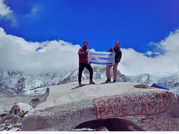
Fascinating Mount Everest Facts You Should Know
These Mount Everest facts are drawn from official surveys, the Himalayan Database and Nepal's Department of Tourism, current to November 2026.
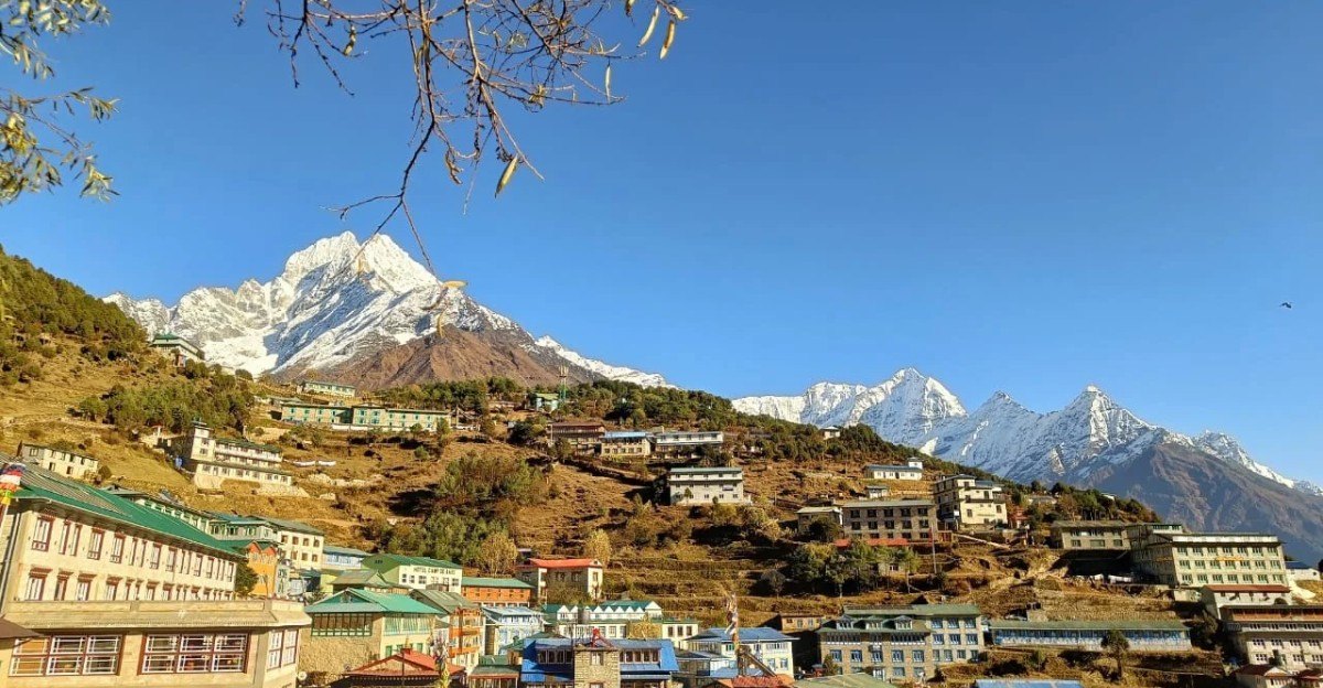
Height and location facts
- Everest is still growing. GPS instruments show the summit area rising by about 2 mm a year as the Indian plate keeps pushing north.
- The summit is an old seabed. The top layer of rock is limestone that formed under a tropical ocean more than 400 million years ago, and it contains marine fossils.
- The border crosses the summit. You can stand with one foot in Nepal and one in Tibet, although few climbers spend more than a few minutes on top.
- Everest towers over its neighbours. It is about 240 m higher than K2 (8,611 m), the world's second-highest mountain.
Weather facts
- The summit has about one-third of sea-level air pressure. Each breath carries roughly a third of the oxygen you would get at the beach.
- The summit never thaws. Temperatures stay below freezing all year and can fall below minus 40°C in winter.
- The jet stream sits on the mountain most of the year. Winds can reach hurricane force, which is why climbers wait for short calm spells called summit windows.
- Most summits happen in a few May days. In spring 2026, about 80% of Nepal-side summits came between 17 and 26 May.
Climbing history and record facts
- Sherpas and other hired staff have made more summits than paying clients. Of 13,737 summits recorded by the end of 2025, 7,081 (52%) were by hired support climbers.
- Very few people climb without bottled oxygen. Only about 1.7% of summiters, 232 climbers, have reached the top without supplemental oxygen.
- Kami Rita Sherpa holds the record for most ascents. He reached the summit for the 32nd time on 17 May 2026, more than three decades after his first ascent in 1994.
- Lhakpa Sherpa holds the women's record. She made her 11th ascent on the same morning, 17 May 2026.
- No year since 1981 has passed without a death on Everest, according to Himalayan Database records.
Mount Everest in 2026: what changed?
The spring 2026 season was the busiest in Everest's history, and it brought rule changes every future climber and trekker should know about.
- Higher permit fee. Since 1 September 2025, a foreign climber on Nepal's standard route pays a royalty of US$15,000 in spring, up from US$11,000. The autumn fee is US$7,500 and the winter and summer fee is US$3,750.
- Record permits. Nepal issued about 495 Everest climbing permits for spring 2026, the most ever.
- Record summits. More than 1,000 summits were made from the Nepal side, beating the previous season record of 877 set in 2019. On 20 May 2026 alone, 274 people reached the top, the highest single-day total recorded.
- The Tibet side was closed. China kept the north side closed to foreign teams for spring 2026, so almost every international expedition used the South Col route.
- Stricter rules are being debated. Nepal's Tourism Bill 2081 would require Everest climbers to have first summited a 7,000 m peak in Nepal. It passed the National Assembly in February 2026 but, as of November 2026, was still being reviewed by a House of Representatives committee and was not law.
The History of Mount Everest: From Early Expeditions to Modern Climbs
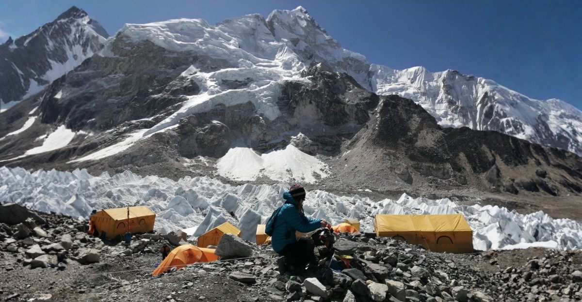
Mount Everest history spans about 170 years, from a number in a survey ledger to a mountain climbed by hundreds of people each spring.
How was Mount Everest discovered and measured?
In the mid-1800s, the Great Trigonometrical Survey of India was mapping the Himalayas from the plains. Nepal and Tibet were closed to foreigners, so surveyors had to measure distant peaks from stations in India more than 150 km away.
In 1852, Radhanath Sikdar, an Indian mathematician working for the survey, calculated that Peak XV was the highest mountain then known. The result was checked for several years and announced in 1856. The peak was named Mount Everest in 1865.
What happened on the early Everest expeditions?
The first expeditions came from Tibet, because Nepal stayed closed until 1950.
- 1921: A British reconnaissance team, including George Mallory, mapped the northern approach and found a route to the North Col.
- 1922: The first serious summit attempt used bottled oxygen for the first time. An avalanche killed seven porters, the first recorded deaths on the mountain.
- 1924: Mallory and Andrew Irvine disappeared high on the Northeast Ridge on 8 June. Whether they reached the summit remains one of mountaineering's great unsolved questions. Mallory's body was found in 1999.
- 1951 and 1952: After Nepal opened its borders, a British team scouted the Khumbu Icefall. In 1952, a Swiss expedition pushed Tenzing Norgay and Raymond Lambert to roughly 8,600 m on the South Col route.
How did Hillary and Tenzing make the first ascent in 1953?
The 1953 British expedition, led by John Hunt, used the route the Swiss had opened through the Khumbu Icefall, the Western Cwm and the South Col. On 26 May, Tom Bourdillon and Charles Evans reached the South Summit but turned back, short on time and with oxygen problems.
Three days later, at 11:30 am on 29 May 1953, New Zealander Edmund Hillary and Tenzing Norgay stood on the summit. They spent about 15 minutes on top. Hillary photographed Tenzing holding his ice axe, and Tenzing left small food offerings in the snow, in keeping with Buddhist custom. The news reached London on 2 June, the morning of Queen Elizabeth II's coronation.
What are the major milestones in Everest climbing history?
|
Year |
Milestone |
|
1953 |
First ascent: Edmund Hillary and Tenzing Norgay, South Col route |
|
1960 |
First ascent from the north: Chinese climbers Wang Fuzhou, Gonpo and Qu Yinhua |
|
1963 |
Tom Hornbein and Willi Unsoeld climb the West Ridge and make the first traverse |
|
1975 |
Junko Tabei of Japan becomes the first woman to summit (16 May) |
|
1975 |
A British team led by Chris Bonington makes the first ascent of the Southwest Face |
|
1978 |
Reinhold Messner and Peter Habeler reach the summit without supplemental oxygen |
|
1980 |
Krzysztof Wielicki and Leszek Cichy make the first winter ascent (17 February) |
|
1980 |
Messner makes the first solo ascent, without oxygen, from Tibet |
|
1993 |
Pasang Lhamu Sherpa becomes the first Nepali woman to summit; she died on the descent |
|
1996 |
A storm on 10 and 11 May kills eight climbers, later described in the book Into Thin Air |
|
2014 |
An avalanche in the Khumbu Icefall kills 16 Nepali mountain workers on 18 April |
|
2015 |
An earthquake-triggered avalanche hits Everest Base Camp on 25 April, the deadliest disaster in the mountain's history |
|
2019 |
Photos of long queues on the summit ridge spark a global debate about crowding |
|
2020 |
Nepal and China announce the new height of 8,848.86 m |
|
2026 |
Record season from Nepal: more than 1,000 summits and 274 in a single day |
The big shift since the 1990s has been commercial guiding. Today, most climbers join organised expeditions with Sherpa guides, fixed ropes, bottled oxygen and professional weather forecasts.
How Mount Everest Was Formed: Geology of the Himalayas
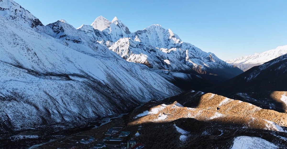
Mount Everest exists because two continents are still colliding beneath it.
How were the Himalayas formed?
More than 100 million years ago, the land that is now India broke away from the ancient southern supercontinent of Gondwana and drifted north across a sea called the Tethys Ocean. Around 50 million years ago, India began to collide with Asia.
Neither landmass could sink easily beneath the other. Instead, the crust crumpled, folded and stacked up in huge sheets, a little like a rug pushed against a wall. That collision built the Himalayas and the high Tibetan Plateau behind them. India is still pushing north today, at roughly 4 to 5 cm a year, so the range is still active and earthquakes are common.
What is Mount Everest made of?
Everest is built from layers that were once at the bottom of the sea, and on a clear day you can pick them out from trekking viewpoints such as Kala Patthar.
- The summit pyramid is grey limestone from the Ordovician period, more than 400 million years old. It holds fossils of sea creatures such as trilobites and crinoids.
- The Yellow Band, a pale stripe below the summit, is a band of marble and other altered rock that climbers cross on both main routes.
- The lower mountain is made of darker metamorphic rocks and granite that formed deep underground under heat and pressure.
Why is Mount Everest so high?
Three forces work together.
- Continental collision keeps squeezing the crust upward. This is the main reason for Everest's height.
- Thick crust under the Himalayas and Tibet floats higher on the Earth's mantle, much as a thick block of wood floats higher in water.
- River erosion may add a boost. A 2024 study in Nature Geoscience suggested that the Arun River, about 75 km east of Everest, captured another river system around 89,000 years ago. The extra erosion removed so much rock that the crust rebounded, possibly adding 15 to 50 m to Everest's height. Other geologists dispute how large this effect is, so treat it as an open scientific question.
Glaciers, wind and frost wear the mountain down at the same time. Everest's height is the balance between uplift and erosion, and for now uplift is winning by a few millimetres a year.
Mount Everest Climbing Routes: South Col and North Ridge
About 98% of all Everest summits are made on two standard routes: the South Col route from Nepal and the North Ridge route from Tibet. More than a dozen other lines exist, such as the West Ridge and the Southwest Face. Together they account for about 1.4% of summits but about 21% of deaths.
What is the South Col route from Nepal?
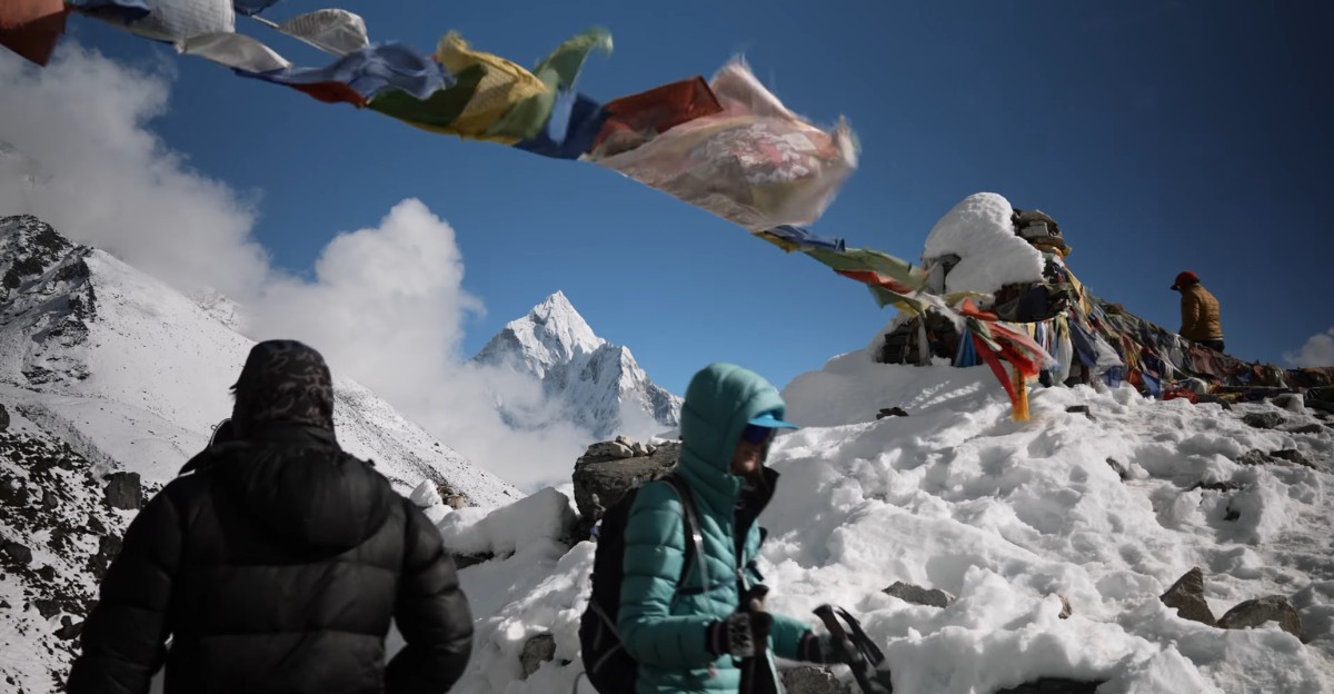
The South Col and Southeast Ridge is the route Hillary and Tenzing climbed in 1953, and it is the most popular of all Mount Everest routes. Climbers fly to Lukla, trek for about eight days to Everest Base Camp, then spend several weeks moving up and down the mountain to acclimatise before a summit push.
- Everest Base Camp (about 5,364 m) on the Khumbu Glacier.
- Khumbu Icefall, a moving maze of ice towers and crevasses crossed on fixed ropes and aluminium ladders.
- Camp 1 (about 6,065 m) at the top of the Icefall.
- Camp 2 (about 6,400 m) in the Western Cwm, a long glacial valley.
- Camp 3 (about 7,160 m) on the steep ice of the Lhotse Face.
- Camp 4 (about 7,950 m) on the South Col, a windswept saddle between Everest and Lhotse.
- The Balcony (about 8,400 m), the South Summit (about 8,750 m) and the Hillary Step, before the final ridge to the top.
The Hillary Step was once a rock wall of about 12 m. Its shape changed after the 2015 earthquake, and it is now usually a steep snow slope.
What is the North Ridge route from Tibet?
The North Col and Northeast Ridge route starts at North Base Camp (about 5,150 m), which can be reached by road. Climbers move to Advanced Base Camp (about 6,400 m), climb to the North Col (about 7,000 m), then follow the exposed ridge to high camps at about 7,700 m and 8,300 m.
The summit day crosses three rock steps. The Second Step, at roughly 8,600 m, is the crux and has a fixed ladder. China closed this route to foreign climbers in spring 2026, and its reopening for 2027 had not been confirmed as of November 2026.
How do the South Col and North Ridge routes compare?
|
Feature |
South Col route (Nepal) |
North Ridge route (Tibet) |
|
First climbed |
1953 |
1960 |
|
Base camp |
About 5,364 m, reached on foot |
About 5,150 m, reached by road |
|
Biggest objective hazard |
Khumbu Icefall: falling ice and crevasses |
Long, exposed ridge high in the death zone |
|
Highest camp |
About 7,950 m (South Col) |
About 8,300 m |
|
Technical crux near the top |
Hillary Step area |
Second Step and its ladder |
|
Weather feel |
Somewhat sheltered until the South Col |
Colder and windier for longer |
|
Summits recorded by end of 2025 |
9,887 from the Nepal side (69%) |
3,850 from the Tibet side (31%) |
|
Spring 2026 status |
Open, record season |
Closed to foreign climbers |
What are the biggest challenges on Everest?
Every route shares the same core problems:
- Altitude, especially above 8,000 m in the so-called death zone.
- Weather, with jet-stream winds and sudden storms.
- Crevasses and seracs, hidden cracks and unstable ice towers.
- Crowding, which can trap climbers in queues while their oxygen runs down.
The section on weather and dangers below explains each one.
Famous Everest Climbers and Historic First Ascents
Everest's story is told through its climbers, and the most important of them have been Sherpa.
Who were Edmund Hillary and Tenzing Norgay?
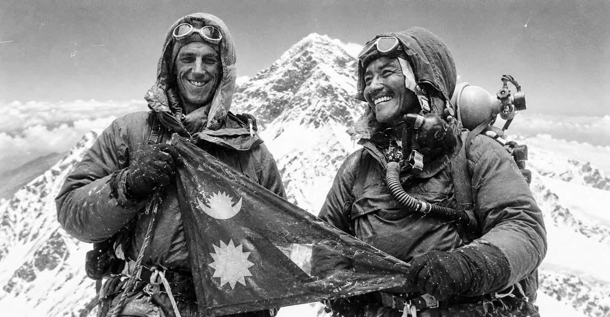
Edmund Hillary (1919 to 2008) was a beekeeper from Auckland, New Zealand, and an experienced alpine climber. After Everest, he spent much of his life giving back to the Khumbu. Through the Himalayan Trust, which he set up in the early 1960s, he helped build Khumjung School, Khunde Hospital and the airstrip at Lukla that most trekkers now use.
Tenzing Norgay (1914 to 1986) was a Sherpa climber who grew up in Thame in the Khumbu and later lived in Darjeeling, India. The 1953 climb was his seventh Everest expedition. He went on to lead field training at the Himalayan Mountaineering Institute in Darjeeling.
For years, the press asked who stepped on top first. Both men said they reached the summit as a team, and that remains the best answer.
Which other climbers changed Everest history?
- Junko Tabei (Japan) became the first woman on the summit in 1975, 12 days after surviving an avalanche at Camp 2.
- Reinhold Messner (Italy) proved Everest could be climbed without bottled oxygen in 1978 with Peter Habeler, then climbed it solo in 1980.
- Pasang Lhamu Sherpa became the first Nepali woman to summit in 1993. She died on the descent and is now a national hero in Nepal.
- Apa Sherpa held the record for most ascents for years with 21 summits.
- Kami Rita Sherpa, born in Thame in 1970, first summited in 1994 and reached his record 32nd summit on 17 May 2026.
- Lhakpa Sherpa began as a porter, became a guide and set the women's record with her 11th summit in 2026.
- Pasang Dawa Sherpa reached his 30th summit in 2026, second only to Kami Rita.
- Kenton Cool (United Kingdom) made his 20th ascent in 2026, the most by a climber from outside Nepal.
Why are Sherpa climbers essential to Everest expeditions?
Almost no commercial expedition reaches the summit without Sherpa and other Nepali mountain workers. Their work starts before clients arrive and continues after they leave.
- The Icefall Doctors, a specialist Sherpa team, build and maintain the ladder and rope route through the Khumbu Icefall each season.
- Rope-fixing teams install the lines all the way to the summit, usually before any client climbs above the South Col.
- Climbing Sherpas carry tents, food and oxygen bottles to the high camps, guide clients on summit day and lead most rescues.
That work carries real risk. Hired support staff account for more than half of all summits, and about 130 of the 339 deaths recorded by the end of 2025, roughly 39%. Many crossed the Khumbu Icefall far more often than their clients.
Sherpa Culture and the People of the Everest Region
The Sherpa are an ethnic group of the high Himalayas, and the Khumbu valleys below Everest are their best-known homeland.
Who are the Sherpa people?
The word Sherpa comes from the Tibetan shar (east) and pa (people), meaning "people from the east". Their ancestors are believed to have migrated from the Kham region of eastern Tibet roughly 500 years ago, crossing the high Nangpa La pass into the Khumbu.
Sherpas speak their own Tibetan-related language. For generations they lived by farming potatoes and barley, herding yaks and trading salt, wool and grain across the passes into Tibet.
One point worth knowing: Sherpa is an ethnic name, not a job title. Many high-altitude workers on Everest today are Sherpa, but others come from different Nepali communities such as the Tamang, Rai and Gurung.
What is Sherpa culture like?
Sherpa culture is rooted in Tibetan Buddhism, mainly the Nyingma school, blended with older beliefs about the spirits of land and mountains.
- Sacred mountains. Everest is home to Miyolangsangma, a goddess of generosity. The peak of Khumbila, above Khumjung, is the protector of the Khumbu and is not climbed.
- Prayer flags, mani stones and stupas. Coloured flags carry prayers on the wind, and carved stones line the trails. Keep them on your right as you pass, walking clockwise, as locals do.
- The puja. Before an expedition sets foot on the mountain, a lama leads a ceremony at Base Camp to ask the mountain's permission and bless the climbers, their ice axes and their crampons.
- Monasteries and festivals. Tengboche Monastery, founded in 1916 and rebuilt after an earthquake and a fire, hosts the masked Mani Rimdu festival each autumn. Losar, the Sherpa New Year, falls in February or March.
What role do Sherpas play in trekking and mountaineering?
Sherpas have worked on Himalayan expeditions since the British attempts of the 1920s. Today, Sherpa families own many of the lodges, teahouses, trekking companies and expedition agencies in the Khumbu.
Tourism has brought schools, health posts, electricity and new income to the region. It has also brought pressure on forests, water and waste systems, and real danger for the workers who climb high. Choosing operators that pay fair wages and provide insurance and proper gear for their staff makes a difference.
What is Sagarmatha National Park?
Sagarmatha National Park protects the Nepal side of Everest and the Sherpa homeland around it.
|
Fact |
Detail |
|
Established |
19 July 1976 |
|
UNESCO World Heritage Site |
Since 1979 |
|
Area |
1,148 km², plus a 275 km² buffer zone added in 2002 |
|
Elevation |
From about 2,845 m to the summit of Everest |
|
Wildlife |
Snow leopard, red panda, Himalayan tahr, musk deer and the Danphe (Himalayan monal), Nepal's national bird |
|
Main villages |
Namche Bazaar, Khumjung, Khunde, Thame, Pangboche, Phortse and Dingboche |
|
Special feature |
The Gokyo Lakes, listed as a wetland of international importance in 2007 |
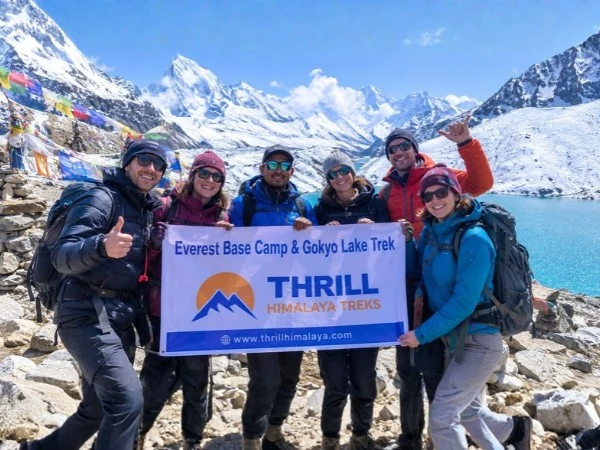
You do not need to climb Everest to experience this world. Thousands of trekkers each year walk to Everest Base Camp, Kala Patthar or the Gokyo Lakes, staying in Sherpa lodges along the way.
Weather, Altitude, and Dangers of Climbing Mount Everest
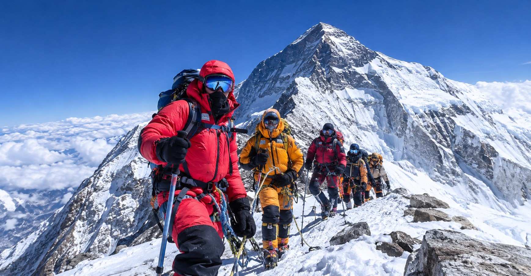
Everest is dangerous mainly because of thin air, extreme cold and unstable ice, and these risks grow sharply above 8,000 m.
What is Mount Everest weather like?
Mount Everest weather is shaped by two systems: the jet stream and the monsoon. For most of the year, the jet stream blows across the summit at hurricane strength. From June to September, the monsoon brings heavy snow to the Nepal side.
In May, just before the monsoon arrives, the jet stream usually lifts north for a few days at a time. These calm spells are the summit windows that almost every expedition waits for. A shorter, colder window can open in autumn, but far fewer people climb then.
Why is there so little oxygen at the top?
The air at the summit still contains about 21% oxygen, the same share as at sea level. The problem is pressure. At 8,849 m, air pressure is only about one-third of sea-level pressure, so each breath delivers roughly a third of the oxygen your body expects.
Above about 8,000 m, the human body cannot adapt. Climbers call this the death zone: the body slowly breaks down, thinking becomes muddled and every step takes several breaths. This is why almost all climbers use bottled oxygen and spend as little time as possible up high.
What are the main dangers of climbing Everest?
- Altitude illness. Acute mountain sickness causes headache, nausea and poor sleep. It can progress to high-altitude pulmonary oedema (fluid on the lungs) or high-altitude cerebral oedema (swelling of the brain). Both can kill quickly, and going down is the most important treatment.
- Frostbite and hypothermia. Wind chill near the summit can freeze exposed skin within minutes. Fingers, toes and faces are most at risk.
- Avalanches and falling ice. The Khumbu Icefall moves constantly. In 2014, a falling serac killed 16 workers, and in 2026 a huge ice block near the top of the Icefall delayed the route for almost two weeks.
- Crevasses. Deep cracks in glaciers may be hidden by snow. Ladders, fixed ropes and roping up reduce the risk but do not remove it.
- Exhaustion and falls on the way down. Research on Everest deaths has found that most happen high on the mountain during the summit bid, often during the descent.
- Crowding. Long queues on narrow ridges mean more time in the death zone and more oxygen used.
By the end of 2025, the Himalayan Database had recorded 339 Mount Everest deaths, about 1.06 deaths for every 100 summits. Five more people died in spring 2026, the same number as in 2025 and far fewer than the 18 deaths of 2023.
Why do preparation, acclimatisation and experienced guides matter?
No amount of fitness prevents altitude illness, but good preparation lowers the odds of things going wrong.
- Acclimatisation. Climbers follow a climb-high, sleep-low pattern over several weeks so the body can make more red blood cells.
- Experience. Reputable operators expect clients to have climbed high, glaciated peaks first, and Nepal may soon make a 7,000 m summit compulsory.
- Experienced guides. Sherpa guides who know the route can read conditions, manage oxygen and enforce turnaround times, which are the times climbers must turn back whether or not they have reached the top.
- Insurance and rescue planning. Check that your policy covers the altitude and the activity, including helicopter evacuation, before you go.
If you are trekking rather than climbing, the same principles apply on a smaller scale: ascend gradually, include rest days and descend if symptoms get worse.
Mount Everest Records, Facts, and Frequently Asked Questions
The headline Mount Everest records below are current to the end of the spring 2026 season.
|
Record |
Holder |
Detail |
|
Most summits by anyone |
Kami Rita Sherpa |
32 summits, the latest on 17 May 2026 |
|
Second-most summits |
Pasang Dawa Sherpa |
30 summits, the latest in May 2026 |
|
Most summits by a woman |
Lhakpa Sherpa |
11 summits, the latest on 17 May 2026 |
|
Most summits by a climber from outside Nepal |
Kenton Cool (UK) |
20 summits, the latest in 2026 |
|
Fastest Base Camp to summit, with oxygen |
Tyler Andrews (USA) |
9 hours 55 minutes, 27 to 28 May 2026; some climbers question how the record was set |
|
Oldest person to summit |
Yuichiro Miura (Japan) |
Aged 80, in 2013 |
|
Youngest person to summit |
Jordan Romero (USA) |
Aged 13, in 2010, from the Tibet side |
|
Most summits in one day |
Nepal side |
274 summits on 20 May 2026. |
|
Most summits in one season |
Nepal side |
More than 1,000 in spring 2026 |
Frequently asked questions about Mount Everest
Where is Mount Everest located?
Mount Everest is in the Mahalangur Himal range of the Himalayas, on the border between Nepal and the Tibet Autonomous Region of China. The south side lies in Nepal's Solukhumbu District inside Sagarmatha National Park, and the north side lies in Tingri County, Tibet.
How high is Mount Everest?
Mount Everest is 8,848.86 metres (29,032 ft) high. Nepal and China announced this official height together on 8 December 2020, replacing the older figure of 8,848 m.
Can you climb Mount Everest without experience?
You should not, and reputable operators will not take you. Most ask for proof of earlier climbs on high, glaciated peaks, often including a Himalayan peak of 6,000 m or more. Nepal's proposed Tourism Bill would make a 7,000 m summit in Nepal a legal requirement, although it was not yet law in November 2026. If you have no climbing experience, trekking to Everest Base Camp is the realistic way to see the mountain up close.
How long does it take to climb Mount Everest?
A standard expedition from Nepal takes about two months, from arrival in Kathmandu to departure. Most of that time is spent acclimatising on rotations between Base Camp and the higher camps. The final summit push from Base Camp usually takes four to five days, and summit day itself often lasts 12 hours or more from the South Col up and back.
What is the best time to climb Mount Everest?
The best time to climb Mount Everest is from mid to late May, when the jet stream briefly lifts away from the summit before the monsoon. A smaller window can open in autumn after the monsoon, but it is colder, snowier and far less used. For trekkers, the best seasons in the Everest region are spring (March to May) and autumn (late September to November).
Why is Mount Everest called Sagarmatha?
Sagarmatha is the Nepali name for Mount Everest, adopted by the Government of Nepal in the 1960s. It is commonly translated as "forehead of the sky" and gives Nepal a name of its own for the peak, alongside the Tibetan name Chomolungma.
Is Mount Everest in Nepal or China?
Mount Everest is in both countries. The Nepal and China border runs across the summit, so the south face belongs to Nepal and the north face belongs to the Tibet Autonomous Region of China. Most climbers and almost all trekkers approach from the Nepal side.
Conclusion: Experience Mount Everest for Yourself
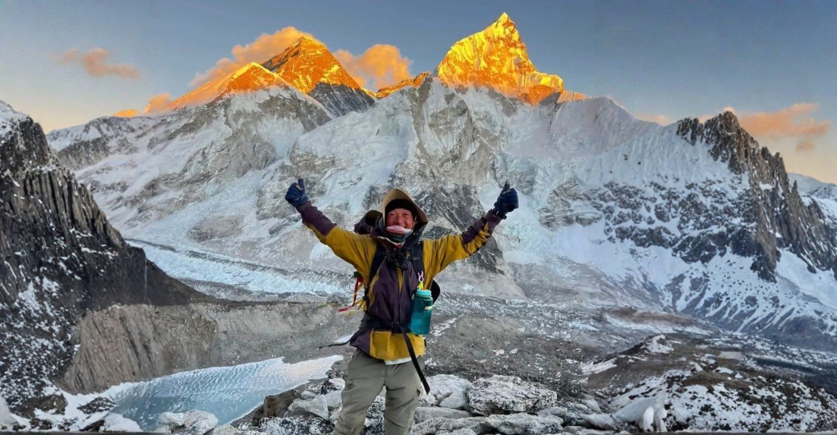
Mount Everest is more than a record or a number. It is a young mountain still rising from an ancient seabed, a peak with three names and three histories, and the spiritual centre of the Sherpa homeland. Its story runs from the surveyors of the 1850s to Hillary and Tenzing in 1953, and on to the record-breaking climbers of 2026.
Mount Everest is more than a record or a number. It is a young mountain still rising from an ancient seabed, a peak with three names and three histories, and the spiritual centre of the Sherpa homeland. Its story runs from the surveyors of the 1850s to Hillary and Tenzing in 1953, and on to the record-breaking climbers of 2026.
Most people who fall for Everest never climb it, and they do not need to. Walking through the Khumbu, you pass prayer walls and monasteries, sleep in Sherpa lodges in Namche Bazaar and Dingboche, and watch the summit pyramid catch the first light from Kala Patthar. That journey shows you the mountain, its people and its culture at a pace your body can handle.
If Everest has sparked your curiosity, start by learning more about Nepal's mountain regions and the treks that lead into them. When you are ready to plan, our Kathmandu team can talk you through the Everest Base Camp, Gokyo Lakes and other Khumbu routes, and help you choose the one that suits your time, fitness and interests.
Explore all Thrill Himalaya trekking packages
- Annapurna Base Camp with Mardi Himal Trek
- Annapurna Base Camp Trek - 10 Days
- Annapurna Base Camp Trek
- 6-Day Annapurna Base Camp Trek for Beginners
- Annapurna Base Camp Trek for Seniors
- Annapurna Base Camp Trek with Family and Kids
- Annapurna Circuit Trek
- Everest Base Camp Helicopter Tour
- Everest Base Camp Trek
- Everest Base Camp Trek via Salleri
- Everest Base Camp Trek with Heli Return
- Everest Base Camp Trek with Island Peak Climbing
- Everest Base Camp with Gokyo Lake Trek
- Everest Three Passes Trek
- Ghorepani Poon Hill Trek
- Gokyo Lake Trek
- Island Peak Climbing
- Manaslu Circuit Family Trek
- Manaslu Circuit Trek
- Manaslu Circuit Trek with Tsum Valley
- Mardi Himal Trek
- Mera Peak Climbing
- Pikey Peak Trek
- Short Annapurna Base Camp Trek -- 5 Days
- Short Annapurna Base Camp Trek -- 7 Days
- Short Manaslu Circuit Trek
- Tsum Valley Trek
Related travel and trekking blogs
- 7 Off-the-Beaten Treks in Nepal
- Annapurna Base Camp Trek Difficulty
- Best Time for Manaslu Circuit Trek
- Best Time to Trek in Nepal
- Best Treks in Nepal
- Manaslu Circuit Trek Complete Guide
- Dashain Tika Time 2026
- Everest Base Camp Trek in November
- How Difficult Is Manaslu Circuit Trek?
- How Do I Prepare for a Trek to Everest Base Camp?
- Manaslu Circuit Trek Duration
- Manaslu Circuit Trek Permits
- Is Nepal Safe After Flood?
- Langtang Valley Trek Distance
- Manaslu Circuit Trek: 14 Days Complete Itinerary from Kathmandu
- Manaslu Circuit Trek After Budhi Gandaki Flood
- Manaslu Circuit Trek Guide, Cost, Itinerary and Difficulty
- Manaslu Circuit Trek Nepal: Route, Highlights and Tips
- Manaslu Circuit Trek Guide
- Mount Everest Guide
- Nepal Premier League Cricket Travel Guide
- Nepal Travel Tips
- Tihar Festival in Nepal