Manaslu Circuit Trek with Tsum Valley - 18Days

40 reviews in TripAdvisor
Recommended by 99% of travelers

What Is the Manaslu Circuit Trek with Tsum Valley?

The Manaslu Circuit Trek with Tsum Valley 18 Days joins two of Nepal's restricted areas into one journey. You walk up the Budhi Gandaki gorge, turn east into Tsum Valley for five days of monasteries and Tibetan Buddhist villages, then return to the main trail and complete the classic Manaslu Circuit over Larkya La.

Most trekkers do one or the other. Doing both in a single trip saves you a second flight to Nepal, a second permit fee, and about a week of repeated walking on the lower trail. Our guide Pemba Sherpa puts it simply: "Tsum is the Nepal I grew up in. If you have the days, do not skip it."

The route stays far quieter than Everest or Annapurna. On a busy October day you might share the trail with 30 trekkers. In Tsum Valley, often fewer than 10.

Manaslu Circuit with Tsum Valley Quick Facts

Duration 18 days (21-day relaxed option available)
Total distance About 200 to 215 km on foot, 11 to 15 km per day
Highest point Larkya La Pass, 5,106m
Difficulty Challenging. Long days, one 5,000m pass, remote terrain
Cost From USD [1,150] per person, group discounts apply
Permits Manaslu RAP, Tsum Valley RAP, MCAP, ACAP
Guide Licensed guide mandatory (restricted area rule)
Best time March to May, late September to November
Accommodation Teahouses throughout, basic in Tsum and Dharamsala
Start / End Kathmandu to Machha Khola / Dharapani to Kathmandu

Why Combine Tsum Valley with the Manaslu Circuit?

Because the two areas share the same access trail. You have already paid for the permits, the transport, and the walk up the Budhi Gandaki. Adding Tsum costs five to six extra days and roughly USD [300 to 400], far less than returning for a separate trek later.

Manaslu Circuit Trek with Tsum Valley Highlights

  • Mu Gompa (3,700m), a working monastery near the Tibetan border and the highest point in Tsum Valley
  • Rachen Gompa, a nunnery set in a wide glacial valley, and Milarepa's Cave, where the Tibetan saint is said to have meditated
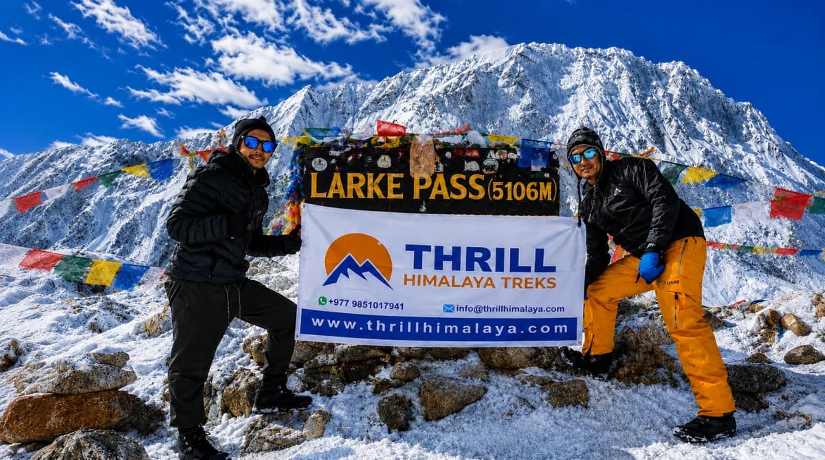
  • Crossing Larkya La Pass (5,106m) with sunrise views over Himlung, Cheo Himal, and Annapurna II
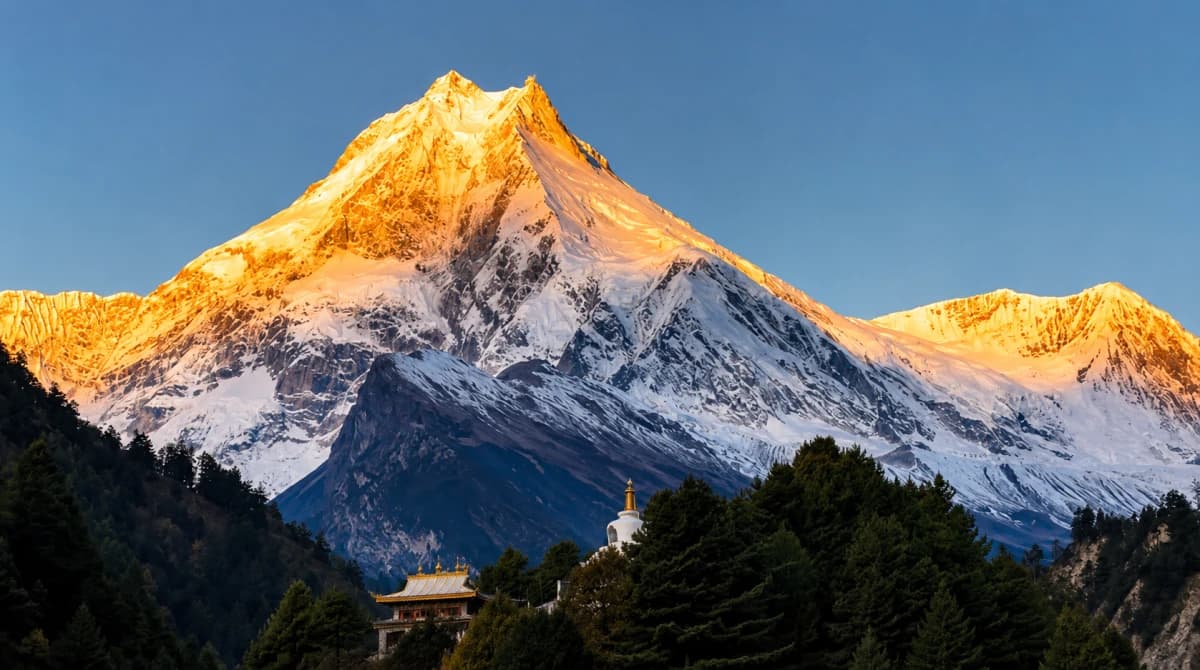
  • Close-up views of Manaslu (8,163m), the world's eighth highest mountain, from Samagaon and Pungyen Gompa
  • Villages in Tsum that still follow a centuries-old non-violence code called Shyagya, where hunting and animal slaughter are banned
  • An acclimatization day at Samagaon with an optional hike to Manaslu Base Camp


How Far Is the Manaslu Circuit Trek with Tsum Valley? Route Map and Distance

You walk about 200 to 215 km in total on the Manaslu Circuit Trek with Tsum Valley, averaging 11 to 15 km per day over 5 to 7 hours of walking. The Tsum Valley detour alone adds roughly 75 to 80 km round trip from the junction at Lokpa, which is why it needs those five to six extra days.

Here is how the distance breaks down, stage by stage. Treat the figures as close estimates. GPS tracks vary a little depending on side trips and where your teahouse sits in each village.

Route section Days Distance
Kathmandu to Machha Khola (jeep) Day 1 160 km by road
Machha Khola to Lokpa (lower Budhi Gandaki) Days 2 to 3 ~32 km
Tsum Valley loop: Lokpa to Mu Gompa and back Days 4 to 8 ~75 km
Lokpa to Samagaon (main circuit trail) Days 9 to 11 ~55 km
Samagaon to Dharapani via Larkya La (5,106m) Days 13 to 16 ~52 km
Dharapani to Kathmandu via Besisahar (jeep) Day 17 ~230 km by road

Two days deserve extra respect on the Manaslu Tsum Valley trek map. The Larkya La crossing on day 15 covers about 15 km but takes 8 to 10 hours because of the altitude, the 3 am start, and the steep descent to Bimthang. And day 16, Bimthang to Dharapani, is the longest walking day at around 24 km, though it runs downhill through pine and rhododendron forest.

Where does the trail split for Tsum Valley?

The Tsum Valley trail leaves the main Manaslu Circuit just past Philim, near Ekle Bhatti, and climbs northeast into the Shiar Khola valley toward Lokpa. You return by the same junction after Mu Gompa, then continue up the Budhi Gandaki toward Deng and the circuit proper. Our guides walk this junction dozens of times each season, so route-finding is never your problem.

[Add here: route map graphic showing the full circuit with the Tsum Valley detour marked in a second colour, plus an altitude profile chart from Machha Khola to Larkya La to Dharapani. Both are strong assets for image search and AI Overviews]

Printed maps like Himalayan Map House and National Geographic cover the region if you enjoy following along, but trails shift after every monsoon. Your guide carries current knowledge no map can print.

How Much Does the Manaslu Circuit Trek with Tsum Valley Cost?

Our Manaslu Circuit Trek with Tsum Valley cost starts at USD [1,150] per person for the full 18-day package. The price drops as your group grows because guide, porter, and transport costs are shared.

Group size Price per person (USD)
Solo trekker $[1,350]
2 to 4 people $[1,250]
5 to 8 people $[1,190]
9 or more $[1,150]

Which Permits Do You Need for the Manaslu Circuit Trek with Tsum Valley?

You need four permits, and we arrange all of them for you. Both Manaslu and Tsum Valley are restricted areas, so each has its own Restricted Area Permit on top of the two conservation area permits.

Permit Autumn (Sep to Nov) Other months
Manaslu Restricted Area Permit (RAP) USD 100 first week, USD 15 per extra day USD 75 first week, USD 10 per extra day
Tsum Valley Restricted Area Permit USD 40 per week USD 30 per week
Manaslu Conservation Area Permit (MCAP) NPR 3,000
Annapurna Conservation Area Permit (ACAP) NPR 3,000

Two more things trekkers often ask about. First, a TIMS card is not required for the Manaslu region. Second, the Chumnubri Rural Municipality collects a local fee of NPR 1,000 to 2,000 at Jagat, paid on the spot.

Can you trek solo? Yes, since March 22, 2026, Nepal's Department of Immigration no longer requires a two-person minimum for the Manaslu Restricted Area Permit. A licensed guide remains mandatory, so solo trekkers book a private guide rather than joining a stranger's permit.

How Difficult Is the Manaslu Circuit Trek with Tsum Valley?

This is a challenging trek, and we tell every client that honestly before they book. You walk 15 to 18 days back to back, cross one 5,000m pass, and spend several nights above 3,500m. The trail itself is well maintained, but the Larkya La crossing means a 3 am start, up to 9 hours of walking, and possible snow even in good seasons.

The good news: the Tsum Valley section works in your favour. Those five days between 2,200m and 3,700m give your body a long, gradual acclimatization that trekkers on the standard circuit do not get. Our clients cross Larkya La in noticeably better shape because of it.

This trek is right for you if

  • You can comfortably hike 6 to 7 hours a day for two weeks or more
  • You have done at least one multi-day trek before, ideally above 4,000m
  • You want culture and mountains together, not just a pass-crossing achievement
  • You are happy with basic teahouses, shared bathrooms, and no WiFi for days

Choose a different trek if

Honest fitness check, free of charge. Message us on WhatsApp at +977 9851017941, tell us your trekking history, and we will tell you straight whether this trek suits you or whether a shorter route is smarter.

When Is the Best Time for the Manaslu Circuit Trek with Tsum Valley?

Late September to November is the best time for the Manaslu Circuit Trek with Tsum Valley. Skies stay clear after the monsoon, Larkya La is usually snow-free until late November, and daytime trail temperatures are comfortable. March to May is the second-best window, with rhododendron forests in bloom below Namrung and warmer nights, though afternoon haze can soften the views.

December to February is possible for experienced winter trekkers, but Larkya La sees heavy snow and Dharamsala's teahouse may close. June to mid-September brings monsoon rain, leeches on the lower trail, and landslide risk on the Budhi Gandaki road. We do not recommend the combined trek in monsoon.

What Will You See in Tsum Valley? Monasteries and Living Culture

Tsum Valley opened to foreigners only in 2008, and it shows. The valley follows Tibetan Buddhism in a way you rarely see elsewhere in Nepal. Mani walls line the trail, prayer flags mark every ridge, and the Shyagya tradition has banned hunting and animal slaughter here for centuries.

The cultural highlights, in the order you reach them:

  • Rachen Gompa, a nunnery on the valley floor near Chhokangparo, home to dozens of nuns who often welcome respectful visitors to morning prayers
  • Mu Gompa (3,700m), the valley's largest and highest monastery, a half-day walk from the Tibetan border, with views up the Lungdang glacier valley
  • Milarepa's Cave (Piren Phu), where the 11th-century Tibetan poet-saint is said to have meditated, with rock carvings and a small shrine

Dress modestly at monasteries, ask before photographing people, and walk clockwise around mani walls and chortens. Your guide will brief you on etiquette, and a small donation at each gompa is appreciated. Want the monasteries without the high pass? Our Tsum Valley Monastery Trek focuses entirely on the sacred gompas in 12 to 14 days.

Combined Trek vs Separate Treks: Which Should You Choose?

  Combined (this trek) Manaslu Circuit only Tsum Valley only
Days 18 to 21 12 to 14 14 to 16
Highest point 5,106m (Larkya La) 5,106m (Larkya La) 3,700m (Mu Gompa)
Best for Mountains plus deep culture in one trip Pass crossing on limited holiday time Culture focus, no high pass
Cost from $[1,150] $789 $[XXX]
Page You are here 14-day itinerary Tsum Valley Trek

The maths favour the combined trek if you have the time. Doing the two treks separately means paying the Manaslu RAP, MCAP, transport, and international flights twice. The combined route adds roughly USD [300 to 400] to a circuit booking and covers everything in one trip.

Why Book the Manaslu Circuit Trek with Tsum Valley with Thrill Himalaya?

We are a local, Nepali-owned agency based in Kathmandu, registered with the Nepal Tourism Board (Reg. No. 3303/81/82) and a TAAN member,  running treks in the Manaslu region with many years of experience.Our guides are Nepal government-certified with wilderness first aid training, and several grew up in the Budhi Gandaki villages you will walk through.

  • Small groups only. We cap groups so your guide actually knows how each person is coping with altitude
  • Safety-first pass crossing. We carry a pulse oximeter, check oxygen saturation daily above Samagaon, and never push a sick client over Larkya La
  • Personal Kathmandu briefing. You meet your guide before the trek, check your gear together, and go through the route day by day
  • Fair porter treatment. Proper loads, insurance, and equipment for every crew member

[Add here: TripAdvisor rating and review count, Google Reviews stars, 2 to 3 short client testimonials from past Manaslu or Tsum departures, NTB and TAAN badge images]

How Do You Book This Trek?

  1. Send an enquiry on WhatsApp or email with your preferred dates and group size
  2. Get your personalised quote within 24 hours, including any itinerary changes you want
  3. Confirm with a deposit, and we lock in your guide, permits paperwork, and transport
  4. Send us your passport scan and photos so permits are ready before you land
  5. Arrive in Kathmandu for your airport pickup and pre-trek briefing, then start walking

Itinerary
Trip PlanExpand all

Highlights: Trishuli River valley · Prithvi Highway views of terraced hills · Arughat Bazaar · First glimpse of the Budhi Gandaki gorge

Your guide meets you at your hotel early in the morning, and after loading gear into the vehicle, the drive begins by following the Trishuli River west out of the Kathmandu valley. The first two to three hours run on the paved Prithvi Highway through Naubise and Malekhu, both busy roadside towns where buses and trucks stop for tea and momos, giving you a good sense of everyday Nepal before the mountains take over. At Dhading Besi the road turns north and the character of the drive changes, narrower and increasingly scenic as it climbs through terraced hillsides toward Arughat Bazaar, a proper market town and your last stop with reliable shops and easy phone signal for the next two weeks. From Arughat, the final stretch to Soti Khola and on to Maccha Khola runs on a rougher, unpaved section that hugs the Budhi Gandaki gorge, with the road climbing and dropping along the hillside as the river carves through the valley below. Expect the last two hours to be the bumpiest part of the day. Maccha Khola itself is a small cluster of teahouses right on the riverbank, a good introduction to what accommodation looks like for the rest of the trek: simple rooms, shared bathrooms, and a warm dining hall where the whole group eats together.

Good to know: A private jeep handles the unpaved final stretch far more comfortably than the shared local bus, and it also gives you more control over stops along the way.

Note: Arughat Bazaar is genuinely your last reliable phone signal and shopping stop before the trail. If you have forgotten anything, batteries, snacks, sun cream, this is the place to pick it up.

Max Altitude: 930m / 3,051ftMeals: Lunch, DinnerAccommodation: Teahouse, Maccha KholaMode of Transportation: Local Bus

Highlights: Tatopani hot springs · Suspension bridges over the Budhi Gandaki · Doban village · Permit checkpoint and entry into the Manaslu Conservation Area

This is your first real day of walking, and the route eases you in gently along the Budhi Gandaki River through warm, humid, sub-tropical terrain, so lighter clothing and sun protection matter more today than on almost any other day of the trek. You leave Maccha Khola on a riverside trail through Khorlabesi, a small settlement with a couple of tea stalls, before the trail narrows and crosses the Budhi Gandaki on the first of many suspension bridges you will walk over during this trip. Around mid morning you reach Tatopani, meaning hot water in Nepali, a natural hot spring beside the trail where many trekkers stop to soak tired feet or even take a proper dip. It is a genuinely nice break, worth building in fifteen or twenty extra minutes for. From Tatopani, the trail continues past small farms and riverside terrain to Doban, a good lunch stop, before climbing a short stretch of stone steps and ridgeline path into Jagat. Jagat itself is one of the more attractive villages on the lower trail, with paved stone lanes, a central mani wall, and stone houses that give it a settled, permanent feel compared to the smaller stops earlier in the day. This is also where the trip becomes official in a practical sense: your guide submits your permits at the checkpoint here, officials check your passport details against them, and a local rural municipality fee is collected on top of the government permits. It only takes a few minutes, but keep your passport easily accessible rather than buried in your pack.

Good to know: Bring a small towel if you plan to properly enjoy Tatopani. It is one of the few chances on the whole trek to actually get in warm water outdoors.

Max Altitude: 1,340m / 4,396ftMeals: Breakfast, Lunch, DinnerAccommodation: Teahouse, JagatMode of Transportation: On Foot Trekking

Highlights: Philim, the largest village before Tsum Valley · Ekle Bhatti trail junction · Entering Tsum Valley · Views toward Himalchuli

Today is one of the longer days on the itinerary, both in distance and in how much the landscape changes along the way, so pace yourself and start early. The trail climbs out of Jagat over a rocky ridge toward Salleri, then drops down to Sirdibas, where the valley opens out and walking becomes noticeably easier for a stretch. From there you reach Philim, the largest village you will pass through before Tsum Valley itself, with terraced fields, a school, small shops, and a genuinely good lunch stop. It is worth a short wander through the village if your guide has time built in, since Philim gives you a clear sense of settled Gurung farming life before the trail turns wilder. Just beyond Philim, at a junction known as Ekle Bhatti, the main Manaslu Circuit trail continues straight ahead toward Deng and Namrung, while your route branches north into narrower canyon walls. This is the actual start of Tsum Valley. Local legend holds that the valley was blessed by Padmasambhava, one of the founding figures of Tibetan Buddhism, centuries ago, and from this junction onward you will notice the trail becomes quieter almost immediately, fewer trekkers, smaller settlements, and a stronger sense of being somewhere genuinely off the main circuit. The final hours into Lokpa run through forest and along the river, with your first real views toward Himalchuli opening up as you climb. Lokpa itself is small, just a handful of lodges, but it is the recognized gateway village into Tsum and a good, quiet place to end a long day.

Good to know: This is one of the longer trekking days on the itinerary, so an early start from Jagat, ideally before 7am, helps you reach Lokpa comfortably with daylight to spare.

Max Altitude: 2,240m / 7,349ftMeals: Breakfast, Lunch, DinnerAccommodation: Teahouse, LokpaMode of Transportation: On Foot Trekking

Highlights: Descent into the Lungwa river valley · Rhododendron and pine forest · Syar Khola suspension bridge · Chumling's three monasteries

A shorter day by distance after yesterday's push, though the terrain keeps you honest, this is not a flat stroll. From Lokpa the trail drops down into the Lungwa river valley before climbing steadily back up through dense rhododendron and pine forest. There are no villages at all between Lokpa and Chumling, so today has a genuinely wild, isolated feel compared to the settled lower valley, just forest, birdsong, and the occasional glimpse of Ganesh Himal appearing through gaps in the trees. The trail eventually brings you to the Syar Khola, which you cross on a suspension bridge, and on the far side lies Chumling, your first proper introduction to Tsum Valley village life. Chumling is home to three small monasteries, Panago Gumba, Mani Dhungyur, and Gurwa Gumba, along with a health post and stone houses strung with prayer flags along narrow lanes. Because it is a shorter walking day, you should have energy and daylight left on arrival, and the short uphill walk to the monastery above the village is genuinely worth it, both for a closer look at the gompa itself and for the view back over the rooftops of Chumling toward Ganesh Himal.

Good to know: If you have energy left after arrival, the walk up to the monastery above Chumling is one of the better short side trips on the entire route, and it rarely takes more than thirty minutes each way.

Max Altitude: 2,386m / 7,828ftMeals: Breakfast, Lunch, DinnerAccommodation: Teahouse, ChumlingMode of Transportation: On Foot Trekking

Highlights: Domje, the largest village in Tsum Valley · Butter tea and local Tibetan hospitality · Twin villages of Chhokang and Paro · Mani walls and chortens

The trail continues deeper into Tsum today, and the cultural shift that started yesterday becomes much more obvious. You pass through Domje, the largest and busiest village in the valley, with more shops and a stronger sense of community life than anywhere you have stayed so far, a good place to pause, refill water, and pick up snacks if you need to. As you climb from Domje toward Chekampar, Tibetan Buddhist culture becomes the dominant presence along the trail, mani walls, painted chortens, fluttering prayer flags, and it would not be unusual for a local household to offer you a cup of butter tea as you pass, a genuinely warm gesture worth accepting if you have the time. Chekampar, your destination for the night, is technically two villages built together, Chhokang and Paro, sitting on an open shelf of land with some of the widest views in the valley toward Ganesh Himal. The local community here identifies as Tsombo, an ethnic group of Tibetan origin with its own distinct customs, and Chekampar functions as one of the cultural centers of Tsum Valley, worth a slow evening walk through if you arrive with energy to spare.

Good to know: Chekampar has some of the better lodges in Tsum Valley, a few with more comfortable rooms and better food than what you will find higher up. If a slightly nicer night matters to you before the more basic villages ahead, this is the place to treat yourself.

Max Altitude: 3,031m / 9,944ftMeals: Breakfast, Lunch, DinnerAccommodation: Teahouse, ChekamparMode of Transportation: On Foot Trekking

Highlights: Rachen Gompa, Tsum Valley's principal nunnery · Serpu Khola valley walking · Gho settlement · First views toward the Tibet border region

Today includes one of the genuine cultural highlights of the entire trek. After a short, gentle walk beside the Serpu Khola, you reach Rachen Gompa, the most important nunnery monastery in Tsum Valley and home to a resident community of Buddhist nuns. Unlike some of the monasteries you will pass on this trek, Rachen Gompa is an active, lived-in place rather than a historical site, and the courtyard here is genuinely worth spending real time in rather than rushing through. If your visit happens to coincide with a prayer session, ask your guide about staying to observe quietly from the back, it is a rare and memorable thing to witness, though timing depends entirely on the monastery's own schedule and is never guaranteed. From Rachen Gompa, the trail continues past the small settlement of Gho and climbs gradually into the upper part of the valley, where the landscape visibly opens up, trees thin out, and the terrain starts to feel closer to the Tibetan plateau than to the forested lower valley you started this trek in days ago. Nile, your stop for the night, sits quietly on the west bank of the river, a smaller and calmer village than Chekampar, with fewer lodges but a genuine sense of being close to the edge of things.

Good to know: Rachen Gompa welcomes visitors, but a small donation toward the nunnery is appreciated and goes directly to supporting the community of nuns who live and study there full time.

Max Altitude: 3,361m / 11,026ftMeals: Breakfast, Lunch, DinnerAccommodation: Teahouse, NileMode of Transportation: On Foot Trekking

Highlights: Highest monastery in Tsum Valley · Trans-Himalayan, arid landscape · Yak pastures near the Tibet border · Rows of ancient chortens

A short walk by distance but a genuinely high and dramatic one in character. The trail follows the west bank of the valley through dry, wind-scoured terrain that looks and feels distinctly different from anything lower down, closer to the Tibetan plateau than to Nepal's greener middle hills, past yak pastures and long lines of chortens strung across the landscape. Mu Gompa itself is over a century old, said locally to have been founded by Guru Rimpoche, and it sits on a hilltop at the head of the valley, the highest and most significant monastery in all of Tsum. Inside the monastery, ancient statues, hand painted murals, and spinning prayer wheels fill the interior, and outside, on a clear day, the views back down the valley and toward the peaks marking the Tibetan border are some of the best of the entire trek. Whether you spend the night up at Mu Gompa or return down to Nile the same evening depends mostly on lodge availability and how the group is doing with the altitude, and your guide will make that call with you once you have had proper time to explore. Staying overnight at Mu Gompa, when it works out, gives you a genuinely rare early morning and evening at one of the most remote, quietly powerful places on the whole route. Returning to Nile keeps you at a slightly gentler altitude for the night, which some trekkers prefer at this stage of the trek.

Note: For trekkers with extra energy and good weather, a short optional extension toward the base of Pika Himal is possible from Mu Gompa. This is entirely conditions dependent, ask your guide on the day itself.

Max Altitude: 3,700m / 12,139ftMeals: Breakfast, Lunch, DinnerAccommodation: Teahouse, Mu Gompa or NileMode of Transportation: On Foot Trekking

Highlights: Milarepa's Piren Phu Cave · Descent through Chekampar · Return to lower valley forest · Long, mostly downhill day

The return journey begins today, and rather than simply retracing yesterday's steps, the route takes a slightly different line that brings you close to Piren Phu, the sacred cave associated with the great Tibetan yogi Milarepa, one of the most revered figures in Tibetan Buddhist history. If you stayed overnight at Mu Gompa, the day starts with a short downhill stretch back to Nile before continuing on; if you returned to Nile the evening before, you simply set off from there. His footprint is said to be preserved in the rock inside the cave, and the site itself, wrapped in prayer flags and marked with carved stone scripts, houses two small attached gompas built directly into the rock. It is a genuinely atmospheric stop and one of the more unexpected highlights of the whole trek. From the cave, the trail descends back through Chekampar, and seeing the village again in the afternoon light, heading downhill rather than up, gives it a noticeably different feel than your first visit. The trail continues down through familiar terrain toward Chumling, retracing ground from earlier in the trek but at a faster pace since you are losing altitude rather than gaining it. It is a long day by distance, but the steady downhill grade means it moves faster underfoot than the number suggests.

Good to know: The late afternoon light on this descent, especially around Chekampar, is some of the best for photography on the whole Tsum Valley section, worth keeping your camera out rather than packed away.

Max Altitude: 2,386m / 7,828ftMeals: Breakfast, Lunch, DinnerAccommodation: Teahouse, ChumlingMode of Transportation: On Foot Trekking

Highlights: Retrace through Lokpa · Rejoining the main Budhi Gandaki trail · Bamboo forest · Siringi Himal viewpoint

Today closes the Tsum Valley loop and brings you back onto the main Manaslu Circuit trail. You retrace the route back through Lokpa, the same gateway village you passed through on Day 3, before dropping steeply down to rejoin the Budhi Gandaki gorge near the same junction at Ekle Bhatti where the two trails first split. From here you are officially back on the standard Manaslu Circuit route, and the trail character shifts again, narrowing into a gorge with a couple of genuinely exciting suspension bridge crossings high above the river, before easing into bamboo forest as the trail climbs gradually into the Nupri region. This stretch of forest tends to be more alive with wildlife than anything you saw in Tsum Valley. Keep an eye out for monkeys moving through the canopy and a good variety of birdlife along the trail. Deng, your stop for the night, is a small Gurung village tucked between steep cliffs and the riverbank, simple and quiet, and on clear afternoons it offers a decent viewpoint toward Siringi Himal to the north.

Good to know: Keep your camera or phone easily accessible through the bamboo sections today. Wildlife sightings here tend to be quick and easy to miss if your gear is packed away.

Max Altitude: 1,860m / 6,102ftMeals: Breakfast, Lunch, DinnerAccommodation: Teahouse, DengMode of Transportation: On Foot Trekking

Highlights: Ghap village and its kani gateway · Increasing Tibetan cultural influence · Mani walls and painted chortens · Namrung's stone entrance gate

The trail's character shifts noticeably today as you move deeper into the upper Manaslu region. From Deng the path climbs and drops through the villages of Rana and Bihi Phedi, alternating between riverside walking and short forest climbs through fir, oak, and rhododendron. At Ghap you pass through your first kani, a painted archway chorten that marks the formal entrance to the village and is a style of structure you will see repeatedly from here onward. You will also start walking beside proper mani walls, long stone walls carved with Buddhist scripture, and local custom asks that you pass these on your left, in the same direction the mantras are meant to be read. The final approach into Namrung runs through denser forest before the trail opens onto the village itself, marked by a stone gateway and a small army checkpoint that gives it a clear sense of being a genuine threshold into the upper Nubri region. Namrung is one of the better developed villages on this stretch of the circuit, with a small monastery, carved prayer wheels along the main path, and noticeably more comfortable lodges than you have had for the past several days.

Good to know: Namrung has some of the better lodges on the entire circuit, several with attached bathrooms and even bakery items available. If a more comfortable night matters to you before the terrain opens up higher, this is a good place to book ahead through your guide.

Max Altitude: 2,630m / 8,628ftMeals: Breakfast, Lunch, DinnerAccommodation: Teahouse, NamrungMode of Transportation: On Foot Trekking

Highlights: Lho village and Ribung Gompa · First full view of Mount Manaslu · Open alpine landscape · Himalchuli and Peak 29 coming into view

This is a genuine climbing day, roughly 870 metres of elevation gain over the course of the walk, so treat it with real respect and settle into a steady pace rather than rushing. The reward comes early: Lho, a village built directly around Ribung Gompa, one of the largest and most photogenic monasteries in the region, framed by Manaslu itself rising immediately behind it, likely the single best photo opportunity of the trek up to this point. Past Lho, the trail continues climbing through increasingly open landscape, the forest thinning out as you gain altitude, with Himalchuli and Peak 29 staying in clear view for long stretches of walking. Shyala itself sits on an open shelf of land surrounded by high peaks on almost every side, a small settlement with a handful of lodges and one of the more dramatic mountain backdrops anywhere on the route. Because this day now covers what used to be a longer, more compressed push all the way to Sama Gaun, you arrive in Shyala with genuine time and energy left to properly take in the surroundings rather than pushing straight through.

Good to know: Walk at a pace where you can comfortably hold a conversation today. This is often the first day trekkers genuinely start to notice the altitude, and pacing yourself properly here pays off directly over the following days.

Max Altitude: 3,500m / 11,482ftMeals: Breakfast, Lunch, DinnerAccommodation: Teahouse, ShyalaMode of Transportation: On Foot Trekking

Highlights: Continued views of Himalchuli and Peak 29 · Gentle valley walking · Arrival in Sama Gaun, the main Nubri village

A short, easy morning after yesterday's climb, and a good chance to let your body properly settle at altitude before the acclimatization day ahead. The trail out of Shyala stays largely level, tracing open valley ground with Himalchuli and Peak 29 remaining in view for much of the walk, and the gentle grade makes this one of the more relaxed mornings of the whole trek. Sama Gaun, your stop for the next two nights, is the main village of the Nubri people and noticeably larger and more developed than anywhere you have stayed since Namrung, with a large gompa, several shops, a health post, and even a small heliport, along with your best phone signal and wifi access since Maccha Khola. Because the walking is so short today, you arrive early, with plenty of time to rest, wander the village, or simply sit somewhere with a good view of Manaslu before tomorrow's acclimatization day.

Good to know: Use the extra time this afternoon to hydrate well and rest properly. A short, easy day like this is exactly the kind of day where good acclimatization habits make the biggest difference later on.

Max Altitude: 3,530m / 11,581ftMeals: Breakfast, Lunch, DinnerAccommodation: Teahouse, Sama GaunMode of Transportation: On Foot Trekking

Highlights: Birendra Lake · Manaslu Base Camp · Pungyen Gompa (gentler alternative) · Rest and acclimatization in Sama Gaun

A necessary rest day before you climb higher, built around the day trip up to Manaslu Base Camp. The route climbs past Birendra Lake, a striking glacier fed lake with genuinely turquoise water, continuing on to Manaslu Base Camp itself, a demanding but unforgettable side trip that puts you standing at the foot of the world's eighth highest mountain, surrounded by glacier and moraine. It is a long, strenuous half day, roughly seven to eight hours round trip, and is worth attempting if you are feeling strong and adjusting well to the altitude so far. If the altitude has been catching up with you, or you would simply prefer something gentler, the alternative is Pungyen Gompa, an older monastery tucked beneath Manaslu's east face, reachable on a shorter and considerably easier morning walk that still delivers genuinely close mountain views without the same physical demand. Either option brings you back to Sama Gaun for the same second night, and either way the underlying purpose of today stays the same, giving your body real time to adjust before Samdo and the pass beyond it.

Note: Your guide will help you decide between Base Camp and Pungyen Gompa on the morning itself, based on the weather, how the group is feeling, and how well you are handling the altitude so far. Both are entirely valid choices, and this is not a day to push yourself if you are not feeling right.

Max Altitude: 3,530m / 11,581ftMeals: Breakfast, Lunch, DinnerAccommodation: Teahouse, Sama GaunMode of Transportation: On Foot Trekking

Highlights: One of the longest mani walls on the route · Manaslu's North Face · Samdo's Tibetan refugee history · Short, gentle walking day

Today is a short, gradual walk, and a deliberate one. The light schedule is built in on purpose to give your body an easy day at real altitude before the bigger effort still ahead. The trail crosses the Budhi Gandaki and climbs steadily past one of the longest mani walls you will see anywhere on this trek, an impressive stretch of carved stone that takes a few minutes just to walk alongside. You also get your first proper look at Manaslu's North Face today, a completely different profile from the views you have had over the past several days, worth pausing for. Samdo itself was founded by Tibetan refugees and has close historical ties to cross border trade with Tibet, and both the layout of the village and the customs of the people who live here still reflect that history clearly. Because the walking day is so short, you arrive early afternoon with plenty of time to properly explore the village, rest, and continue acclimatizing before tomorrow.

Good to know: Samdo is a genuinely good village to ask questions in. Many local guides here have direct family or trading history with Tibet, and it is well worth bringing up over dinner if you are curious.

Max Altitude: 3,875m / 12,713ftMeals: Breakfast, Lunch, DinnerAccommodation: Teahouse, SamdoMode of Transportation: On Foot Trekking

Highlights: Larkya Bazaar historic trading site · Views of the Syacha Glacier · Barren high alpine terrain · Final stop before the pass

The trail crosses the Budhi Gandaki one final time near the site of Larkya Bazaar, once a seasonal trading post where Tibetan and Nepali merchants met to exchange goods, before climbing into increasingly bare, rocky, treeless terrain with clear views of the Syacha Glacier spilling down from the peaks above. This is your last stop before the pass, and it is worth setting expectations accordingly. Dharmasala, also known as Larkya Phedi, is less a village than a small, purpose built cluster of basic lodges that exist specifically to support trekkers crossing Larkya La. Do not expect much beyond a roof, a hot meal, and blankets. The rooms are simple and shared bathrooms are the norm, but arriving by early afternoon leaves plenty of time to rest properly, organize your gear for tomorrow's early start, and eat a good dinner. If the sky is clear, step outside after dark for a few minutes, at 4,460 metres with essentially zero light pollution, the night sky here is genuinely extraordinary and worth the cold.

Good to know: Pack your bag fully and lay out tomorrow's gear before you go to sleep tonight. The start is early and often in complete darkness, and there is real comfort in not having to think or search for anything the next morning.

Max Altitude: 4,460m / 14,632ftMeals: Breakfast, Lunch, DinnerAccommodation: Teahouse, DharmasalaMode of Transportation: On Foot Trekking

Highlights: Pre-dawn start under the stars · Larkya La Pass at 5,106m · Views of Himlung Himal, Cheo Himal, Kang Guru, and Annapurna II · Long descent into the meadows of Bimthang

This is the defining day of the entire trek, and everything up to this point has been building toward it. You leave Dharmasala well before sunrise, typically between three and four in the morning, walking by headlamp across moraine and loose rubble while the winds are still calm, since afternoon winds at this altitude can be strong enough to matter. As the sky slowly lightens, the climb steepens, and then comes the moment the whole itinerary has been working toward, cresting Larkya La at 5,106 metres, met by a dense wall of prayer flags and a full 360 degree panorama that genuinely stops most trekkers in their tracks. Himlung Himal, Cheo Himal, Kang Guru, and Annapurna II all stand together in a single ring of ice and light around you, and it is worth taking real time here for photos and simply absorbing where you are before starting down. The descent that follows is steep and demanding on the knees, more so than the ascent for a lot of trekkers, dropping through glacial moraine and loose scree into an entirely different valley on the other side. By the time the terrain eases and the green meadows of Bimthang appear below, it genuinely feels like a reward after a very long day.

Good to know: Trekking poles genuinely earn their place on this descent, not as an optional extra, the terrain underfoot is loose and uneven in places. And save some appetite for tonight. Dinner in Bimthang tends to taste better than any meal you will remember from the entire trip.

Max Altitude: 3,720m / 12,205ftMeals: Breakfast, Lunch, DinnerAccommodation: Teahouse, BimthangMode of Transportation: On Foot Trekking

Highlights: Descent through changing forest zones · Dudh Khola valley · Rejoining the Annapurna Circuit trail · Warmer air and lower altitude

After the effort of the pass, today is almost entirely downhill, and the change in your surroundings happens fast and is genuinely enjoyable to walk through. The trail drops out of high glacier country into rhododendron and pine forest, and eventually oak, tracing the Dudh Khola valley down through smaller settlements including Tilje along the way. The air warms noticeably with every hour of descent, and the vegetation thickens and greens up in a way that feels like an entirely different trek from the barren high country you crossed yesterday. By the time you reach Dharapani, a busy trail junction where this route merges with the classic Annapurna Circuit, you will notice more trekkers on the trail, more developed lodges, and generally more infrastructure than anywhere you have stayed for the past two weeks, a clear sign of rejoining a much more heavily trekked route.

Good to know: Your knees will thank you for shorter, controlled steps on the steeper sections today rather than rushing the descent just because it is downhill. There is no need to hurry. The hardest part of the trek is already behind you.

Max Altitude: 1,963m / 6,441ftMeals: Breakfast, Lunch, DinnerAccommodation: Teahouse, DharapaniMode of Transportation: On Foot Trekking

Highlights: Marsyangdi River valley · Besisahar transition from mountain track to highway · Farewell dinner in Kathmandu

The drive out follows the Marsyangdi River down through the valley to Besisahar, where the road changes from an unpaved mountain track to a proper paved highway for the remainder of the journey, running through Dumre and Mugling before rejoining the Prithvi Highway back into Kathmandu. It is a long day of travel after more than two weeks on foot, but a welcome one, and most trekkers spend it alternating between watching the scenery change back to lowland Nepal and quietly reflecting on the trip behind them. Once you arrive back in the city, your guide drops you directly at your hotel, giving you time to shower and rest before Thrill Himalaya Treks hosts a farewell dinner to properly close out the trip together as a group. It is a good chance to swap photos, thank your guide and porters directly, and mark the end of the adventure, and it is also when you receive your official Trekking Completion Certificate from Thrill Himalaya Treks.

Good to know: A hot shower and a real bed will feel unreasonably good tonight after two weeks of teahouses. Enjoy it fully, you have earned it.

Max Altitude: 1,400m / 4,593ftMeals: Breakfast, Lunch, DinnerMode of Transportation: Local Bus
Start planning today.
Our travel experts are here to help. Our travel experts are here to help. Our travel experts are here to help.
Essential Information

Essential Information for the Manaslu Circuit Trek with Tsum Valley

Essential information at a glance: You sleep in basic teahouses throughout, eat simple carb-heavy meals built around dal bhat, and drink only purified water since nothing from a tap or stream is safe untreated. Altitude sickness is the main health risk above 3,000m, so your guide checks your oxygen levels daily from Samagaon onward. Electricity, hot showers, and WiFi thin out fast past Namrung and mostly disappear in upper Tsum Valley and at Dharamsala. Pack for temperatures from warm daytime sun to well below freezing at night.

Accommodation on the Trek

You stay in family-run teahouses every night, not hotels. Expect a simple twin room with a wooden bed, a thin mattress, and a blanket that is rarely warm enough on its own, which is why we tell every client to bring a proper sleeping bag. Bathrooms are shared, usually a squat toilet, and hot showers cost extra where they exist at all.

Rooms improve and shrink again as you climb. Machha Khola, Jagat, and Namrung have the most comfortable lodges, some with attached bathrooms. Samagaon is the best-equipped stop on the whole route, with a wider choice of teahouses and a few offering pizza and apple pie alongside dal bhat. Tsum Valley and Dharamsala are the most basic links in the chain: thin walls, no heating beyond the dining room stove, and very limited electricity. At Dharamsala specifically, bed numbers are tight and some lodges use tents during peak season, so arrive early.

Rooms are rarely pre-booked bed by bed. Instead, your guide walks ahead or calls ahead to reserve space at each stop, which is one more reason a licensed, well-connected guide matters on this route.

Food and Meals During the Trek

Dal bhat, rice with lentil soup, vegetable curry, and pickle, is the trek's staple meal, and most teahouses offer free refills. You will likely eat it for dinner most nights simply because it gives you the steady carbohydrates a long trekking day burns through. Alongside it, menus offer noodles, fried rice, thukpa (Tibetan noodle soup), momo (dumplings), potatoes, and porridge or eggs for breakfast.

Choice narrows as you climb. Machha Khola and Jagat have the widest menus. By Samdo and Dharamsala, expect two or three simple options rather than a full menu, since every ingredient above Samagaon has to be carried in on foot or by mule. Meat is available lower down but we recommend sticking to vegetarian dishes above 3,000m, since fresh meat storage and transport get less reliable at altitude.

Vegetarian and vegan trekkers are well catered for since dal bhat is naturally plant-based. Tell us about allergies or intolerances when you book so we can brief teahouse owners in advance. Bring a few energy bars or trail mix from home for variety on long days, but plan to eat the bulk of your meals at your teahouse. It is standard trekking etiquette here, since lodge owners rely on food sales, not room rates, to make a living.

Drinking Water and Hydration

Aim for 3 to 4 litres of water a day, more on the Larkya La crossing itself. Dehydration makes altitude symptoms worse, so this is not optional.

Do not drink untreated tap or stream water anywhere on this route. Teahouse tap water usually comes from a local spring or stream and looks clean, but it is not tested. Your options are boiled water bought from the teahouse (the most reliable method at altitude), a water filter or purification tablets, or a UV steriliser pen. Bottled water is sold along most of the route but gets expensive above Samagaon and adds to the region's plastic waste problem, which is a real concern in a valley with no rubbish collection. We recommend a refillable bottle plus tablets or a filter as your main system, with bottled water as backup only.

Safety Tips

Manaslu and Tsum Valley are remote. Once you leave Jagat there is no road, no hospital, and rescue depends on a helicopter being able to fly, which weather does not always allow. That reality shapes how we run this trek.

  • Trek with a licensed guide at all times. It is legally required in both restricted areas and it is also simply safer, since your guide knows the trail, the teahouses, and how to read a change in your condition
  • Buy travel insurance that covers trekking above 5,500m and helicopter evacuation specifically. Standard travel insurance usually excludes high-altitude trekking
  • Carry copies of your permits and passport at every checkpoint, and keep the originals safe with your guide
  • Watch the weather, especially on the Larkya La crossing day. We start at 3 to 4am precisely so you clear the pass before afternoon wind and cloud build up
  • Stay with your group on exposed sections near landslide-prone parts of the lower Budhi Gandaki, particularly just after rain
  • Tell your guide immediately if you feel unwell. Small problems caught early rarely become large ones

Altitude and Acclimatization

You sleep above 3,000m for roughly a third of this trek, and Larkya La itself sits at 5,106m, where the air holds close to half the oxygen you get at sea level. This is the single biggest factor in how your trek goes.

The Tsum Valley route works in your favour here. Those five days climbing gradually from 2,200m to 3,700m at Mu Gompa give your body far more time to adjust than the standard 12-day circuit allows. By the time you reach Samagaon, most of our clients have already built meaningful altitude tolerance.

We still follow the basic rules that prevent altitude sickness. Ascend slowly, sleep at a lower altitude than your highest point of the day where the itinerary allows, drink plenty of water, and avoid alcohol above 3,000m. Above Samagaon, our guides check your oxygen saturation with a pulse oximeter each morning. Mild headache, tiredness, or poor appetite are common and usually settle with rest. Confusion, a worsening headache despite rest, or shortness of breath at rest are signs to descend immediately, and your guide is trained to make that call even if you want to push on.

Weather and Packing Essentials

Daytime temperatures on a clear autumn or spring day feel pleasant, often 15 to 20°C in the lower villages. Nights are a different story. Expect well below freezing at Samdo, Dharamsala, and on pass-day morning, even in the best months. Pack in layers and plan for both extremes in the same day.

Category Key items
Layers Moisture-wicking base layers (avoid cotton), a fleece or light insulation layer, a down jacket for evenings and pass day, a waterproof and windproof outer shell
Extremities Warm hat, sun hat, gloves plus a lighter liner pair, UV-protection sunglasses, buff or scarf for dust
Footwear Broken-in waterproof hiking boots, warm socks for every trekking day, camp shoes or sandals for evenings
Sleep and comfort Sleeping bag rated to at least -10°C, trekking poles, headlamp with spare batteries
Sun and hygiene SPF 50 sunscreen and lip balm, hand sanitiser, wet wipes, toilet paper, a personal first-aid kit
Power and money Power bank (20,000mAh or more), universal adaptor, Nepali cash for the whole trip since there are no ATMs past the trailhead

Common Health Risks and How to Avoid Them

Risk How to avoid it
Altitude sickness (AMS) Ascend gradually, hydrate well, avoid alcohol above 3,000m, and descend at the first serious symptoms
Dehydration Drink 3 to 4 litres daily, more on pass day. Thin, cold mountain air dries you out faster than you notice
Waterborne illness Never drink untreated water. Boil, filter, or purify every time, including water offered at teahouses
Sunburn and snow glare Use SPF 50 sunscreen daily and wear UV-protection sunglasses, especially near Larkya La where snow reflects UV strongly
Blisters and knee strain Wear boots already broken in, use trekking poles on descents, and pack blister plasters and knee supports
Colds and stomach upsets Wash or sanitise hands before eating, eat only freshly cooked food, and carry basic rehydration salts and anti-diarrheal tablets

Know Before You Go

There are no ATMs once you leave the trailhead. Bring enough Nepali cash for the full trek, including tips

  • WiFi and mobile signal are patchy from Namrung onward and largely absent in Tsum Valley and at Dharamsala. Tell family you may be offline for several days
  • Hot showers and device charging almost always cost extra above Machha Khola, more so at higher villages
  • Meals and rooms are usually billed together at your overnight teahouse, and you are expected to eat where you sleep
  • Pack a duffel bag for your porter (soft-sided, no wheels or hard frames) plus a daypack for what you carry yourself
  • Physical preparation matters. Start cardio and stair or hill training at least six to eight weeks before you fly

What Thrill Himalaya Does That Most Agencies Don't

1. A Village-by-Village Connectivity Table
Before you fly, we give you a simple table showing exactly where you'll have mobile signal, WiFi, and charging on each day of the trek, not a vague "expect limited connectivity" line. You'll know in advance that Jagat and Namrung usually have signal, that it disappears through most of Tsum Valley, and that Dharamsala has none at all. Your family back home gets the same table, so nobody worries when you go quiet for a few days, because they already know it's coming.

2. Staggered Pass-Day Start Times
Most agencies send the whole group up Larkya La at the same 3am start, which means slower walkers end up waiting in freezing wind at the top for faster ones, or faster walkers get stuck behind a bottleneck on the narrow switchbacks. We split departure times by pace within your group, so everyone crosses the pass at a sensible speed for their own fitness, with less standing around in the cold and less pressure to keep up with someone else's legs.

Manaslu Circuit Trek with Tsum Valley - 18Days FAQs

The standard itinerary is 18 days, including transport days from Kathmandu. A relaxed 21-day option adds an extra acclimatization day and a Mu Gompa overnight.

Packages run from around USD [1,150] to [1,350] per person depending on group size. This includes permits, guide, porters, meals, teahouse accommodation, and transport.

Yes. Both areas share the same access trail up the Budhi Gandaki, so one itinerary covers both. You need a separate restricted area permit for each region.

Larkya La Pass at 5,106m, crossed on day 16. In Tsum Valley, the highest sleeping point is Mu Gompa at 3,700m.

Yes, four permits: Manaslu Restricted Area Permit, Tsum Valley Restricted Area Permit, Manaslu Conservation Area Permit, and Annapurna Conservation Area Permit.

Yes. A licensed guide is legally mandatory for both restricted areas.

Yes, since March 22, 2026 the two-person minimum was removed. A licensed guide is still required, so solo trekkers book a private guide.

Late September to November is best, followed by March to May. Winter brings heavy snow at the pass, and monsoon (June to September) brings landslide risk.

Yes, it is a challenging trek. You walk long days back to back, cross one 5,000m pass, and spend several nights above 3,500m.

No, not as a first trek. Prior multi-day trekking experience is strongly recommended.

Between 11 and 15km on most days, taking 5 to 7 hours. The Larkya La crossing and the Bimthang-to-Dharapani descent are the longest days.

About 200 to 215km on foot over 15 walking days, plus around 390km of jeep travel to and from the trailheads.

The Tsum Valley trail branches off the main Manaslu Circuit near Lokpa, past Philim, and climbs northeast into the Shiar Khola valley.

Yes, if you have the extra five to six days. Tsum offers monasteries, Tibetan Buddhist culture, and far quieter trails than the main circuit.

Teahouses throughout, with shared bathrooms and basic rooms. Samagaon has the best facilities, while Tsum Valley and Dharamsala are the most basic.

Mainly dal bhat, noodles, momo, thukpa, and simple breakfast items. Menu choice narrows above Samagaon.

No, not without purifying it. Boiled water, filters, or purification tablets are the safest options throughout the trek.

Reduced oxygen above 3,000m. Symptoms include headache, nausea, and fatigue. Gradual ascent and hydration are the main prevention methods.

Limited and unreliable above Namrung, and largely absent in Tsum Valley and at Dharamsala.

Warm and clear by day in good seasons, but well below freezing at night above 3,500m, especially at Samdo, Dharamsala, and on pass day.

A road drive of about 9 hours from Kathmandu to Machha Khola, the trailhead.

A jeep drive from Dharapani to Kathmandu via Besisahar, roughly 230km and 10 to 12 hours.

Its Tibetan Buddhist culture, monasteries like Mu Gompa and Rachen Gompa, and the centuries-old Shyagya non-violence tradition.

Yes, insurance covering trekking above 5,500m and helicopter evacuation, since standard travel insurance usually excludes high-altitude trekking.

You should be able to comfortably hike 6 to 7 hours a day for two weeks or more, ideally with prior experience above 4,000m.

Need Help?
Feel free to call or WhatsApp our expert.
Need Help? Call Us.+977 9851017941