Trekkers are walking the Manaslu Circuit again after the Budhi Gandaki flood, but the route has reopened with partial repairs, not full restoration. The 11 October 2026 flash flood destroyed bridges, trail sections, homes and lodges in the lower valley. Trekkers began re-entering on 16 October, and a TAAN safety advisory on 25 October reported trekking had resumed over Larkya La (Larke Pass). Lower sections now rely on temporary crossings and short bypasses, and authorities have asked trekkers to proceed with caution. Reports also differ on road access and the Tsum Valley branch.
The sources below are dated reports about specific sections. They do not establish conditions along every part of the route on the day you travel, and conditions in a recently flooded valley can change quickly.
What Happened Along the Budhi Gandaki River?
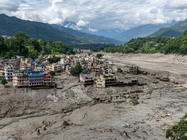
At about 4 am on Sunday 11 October 2026, a debris-laden flash flood came down the Budhi Gandaki, the river the Manaslu Circuit follows for its first several days. ICIMOD's preliminary assessment is that a landslide near Chumchet temporarily blocked the river and the blockage then gave way.
The damage fell mainly on the lower valley, the section between the Chumchet and Lokpa area and Arughat that every circuit trek uses to walk in:
- Bridges: Five bridges were swept away in Dharche Rural Municipality ward 1, four of them footbridges. The Sardibhir cantilever bridge on the Tsum Valley route was also lost.
- Lodges and homes: More than two dozen hotels, including trekker lodges, were destroyed between Yarukhola and Dobhan, and hotels were lost at Tallo Bagar near Jagat.
- Trail: On 14 October, an MCAP information officer said there was no trail left between Philim and Jagat.
- Trekkers: More than 100 foreign trekkers were stranded at points along the route, according to an MCAP official quoted by Reuters on 12 October. Some left by helicopter.
Residents were also reported missing, but early figures varied between reports, so we have not repeated a number here.
The upper circuit was not reported as damaged by this flood. Trekkers who had already passed Philim into the Nubri Valley were able to continue towards Larkya La, according to MCAP.
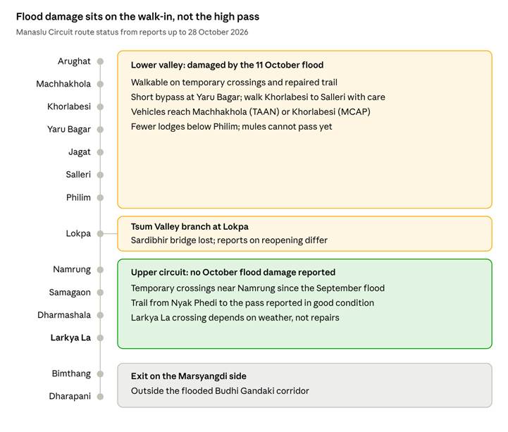
Manaslu Circuit route status after the flood · based on reports to 28 October 202
This was the valley's second flood of the season. On 6 September, the Therang Khola flood at Namrung swept away bridges on the upper circuit. Residents built a temporary wooden bridge at Suksam Khola within two days and trekking resumed.
What Is Confirmed About Reopening and Recovery?
A walkable route through the lower valley was restored within about five days, largely through work by local communities, rural municipalities and conservation staff.
Confirmed progress:
- 16 October: Trekkers began re-entering the Manaslu Conservation Area through the Jagat checkpoint. By 25 October, 116 tourists had entered, with 30 to 35 arriving daily, according to MCAP information officer Bhuwan Ojha.
- 25 October: A TAAN safety advisory reported that trekking had resumed on the circuit via Larke Pass after partial repairs to trails, bridges, access roads and teahouses. It said trekkers had crossed repaired sections through Khorlabesi, Jagat, Philim and Nyak Phedi to reach Samagaon and Dharmashala.
- Permits: The same advisory states that the Department of Immigration and MCAP confirmed the required permits are available.
Reported as incomplete or unresolved:
- Supplies: On 25 October, a Jagat hotel operator said trekkers can walk the lower trail but mules cannot yet pass, which disrupts supply deliveries to villages above.
- Tsum Valley: TAAN reported the Tsum route reopened to Chhekampar and Mu Gompa after community-led repairs that included four wooden bridges. On the same day, MCAP said the Tsum trail would need another 8 to 10 days. Treat Tsum access as unconfirmed until you see a more recent update.
- Permanent rebuilding: The repairs reported so far are temporary crossings, cleared paths and bypasses. We found no published schedule for permanent bridges or road reconstruction.
Weather after reopening: On 28 October, Nepal's Department of Tourism advised trekkers to avoid high-altitude areas from 28 October to 1 November because of forecast heavy rain, snowstorms and possible avalanches. Heavy rain on newly repaired trail is worth watching in the days after a warning like this.
Current Trail, Bridge and Access Conditions
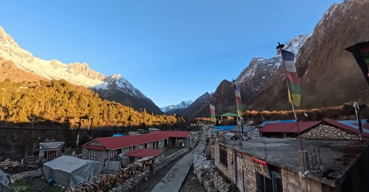
The table brings together the most recent dated report we could find for each section. A blank in our knowledge is stated as such, not filled with a guess.
|
Route section |
Verified information |
Report date |
Source |
What still needs confirmation |
|
Arughat to the trailhead (road) |
Vehicles reach Machhakhola (TAAN); MCAP says vehicles can reach Khorlabesi. A damaged bridge at Arughat was being rebuilt in mid-October, with a suspension bridge in use meanwhile |
14 and 25 October |
Nepal News; The Kathmandu Post |
Where vehicles stop on your travel day; status of the Arughat bridge rebuild |
|
Machha Khola to Jagat |
Walkable with caution. MCAP named Khorlabesi to Salleri as the main problem stretch. A 10-minute bypass trail avoids a difficult section at Yaru Bagar. Mules cannot yet pass |
25 October |
Nepal News; The Kathmandu Post |
Whether the bypass is still in use; any new damage after rain |
|
Jagat to Philim |
Trekkers have crossed repaired sections; on 14 October MCAP had described no trail left here |
25 October |
Nepal News |
Condition of temporary crossings; lodge availability below Philim |
|
Philim to Samagaon and Dharmashala |
Trekkers reached Samagaon and Dharmashala on repaired trail; not reported damaged by the October flood |
25 October |
Nepal News |
Status of the temporary crossings near Namrung built after the September flood |
|
Larkya La (Larke Pass) |
Residents reported the trail from Nyak Phedi to the pass in good condition |
25 October |
The Kathmandu Post |
Snow and weather on your crossing day, especially after the 28 October to 1 November warning |
|
Bimthang to Dharapani (exit) |
No October flood damage found in the reports we reviewed; this section drains to the Marsyangdi, not the Budhi Gandaki |
No specific report found |
n/a |
Current trail and road conditions from Dharapani |
|
Tsum Valley branch (from Lokpa) |
Sardibhir cantilever bridge swept away. TAAN reported reopening with four wooden bridges; MCAP said 8 to 10 more days were needed |
25 October (conflicting) |
Nepal News; The Kathmandu Post |
Whether the route is open on your dates |
Is the Manaslu Circuit Trek Safe After the Flood?
There is no honest yes-or-no answer. Route access and personal safety are different questions, and neither can be guaranteed on a Himalayan trek.
What the evidence supports is narrower: the route is open and in use, trekkers have been crossing the repaired lower sections since mid-October, and authorities have asked them to proceed with caution. What it does not support is a claim that conditions are back to normal. Temporary crossings are, by nature, more exposed to the next heavy rain than permanent bridges.
Whether the trek is right for you also depends on factors the flood did not change:
- Altitude. Larkya La sits at about 5,106 m. The flood did not alter the altitude profile, so acclimatisation still matters, and no itinerary removes the risk of altitude sickness.
- Fitness and footing. Bypass trails and freshly cut paths can be steeper and looser than the original trail. If you have knee, ankle or balance concerns, discuss them before booking.
- Weather. Snow on the pass can delay or prevent a crossing, regardless of trail repairs.
- Remoteness. Mules were not yet passing the lower trail in late October, which affects how supplies move. Evacuation options in mountain areas depend on weather and are never guaranteed.
The Manaslu Circuit is a restricted area, so a licensed guide is required. A guide who receives current information from local contacts is particularly useful while conditions are changing.
How the Situation May Affect Your Itinerary
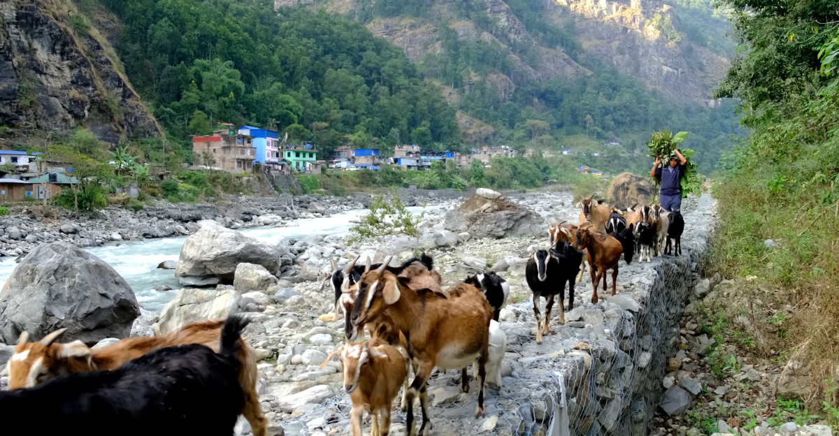
The reports above point to changes in the first few days of the trek, not the high-altitude section.
Changes the reports support:
- Where the drive ends. TAAN and MCAP named different vehicle end points (Machhakhola and Khorlabesi). That can shift the length of your first walking day.
- The walk to Jagat. Expect a short bypass at Yaru Bagar and slower progress on repaired trail between Khorlabesi and Salleri.
- Overnight stops below Philim. With more than two dozen hotels lost between Yarukhola and Dobhan and others at Tallo Bagar, pre-flood overnight stops may not all be available.
- Tsum Valley combinations. A combined Manaslu and Tsum Valley trek depends on the Tsum branch, which was the subject of conflicting reports on 25 October.
General planning considerations:
For more planning context, you can also review our best time for the Manaslu Circuit Trek, Manaslu Circuit Trek 14-day itinerary, and Manaslu Circuit route highlights and tips. These guides cover general planning; this article should be used for the more recent flood-related conditions.
For broader preparation, you can also review our Manaslu Circuit Trek duration guide and Manaslu Circuit Trek difficulty guide.
This article does not describe a fixed change to any Thrill Himalaya departure.
If you are still comparing routes, our Manaslu Circuit Trek guide can help you understand the route and planning considerations alongside this current-condition update. If you are considering a date, ask how that specific trip would be arranged based on the information available at the time.
What to Confirm Before Your Departure
Use this checklist in the week before you travel, and again in Kathmandu. Ask for the date and source of each answer.
Confirm with your trekking company:
- ☐ The latest report for each lower section: Machha Khola to Jagat, Jagat to Philim and, if relevant, Lokpa to the Tsum Valley
- ☐ Which temporary bridges and bypasses are in use, and whether any closed after recent rain
- ☐ Where the vehicle from Arughat is currently stopping, and the transport arrangement to get there
- ☐ Which villages you will sleep in below Philim, and whether those lodges are operating
- ☐ Any change to the itinerary compared with the version you booked
- ☐ The current Restricted Area Permit rules, including guide and group-size requirements, which several operators report changed in 2026
- ☐ The plan if a crossing is closed or Larkya La cannot be crossed on the planned day
Check yourself:
- ☐ Your travel insurance covers trekking to about 5,106 m and helicopter evacuation, confirmed in writing
- ☐ Whether your policy excludes events that were known before you bought it, such as this flood
- ☐ Your government's current travel advice for Nepal
- ☐ Flight flexibility and the rescheduling or cancellation terms in your booking
Planning With Thrill Himalaya Treks
If you are considering the Manaslu Circuit for the rest of this season or for 2027, we can talk through the route with you. Tell us your preferred dates and which itinerary interests you, and we can share the most recent trail information we hold, along with its date and source, before you decide.
We arrange treks with local guides and porters, and itineraries can be adjusted to suit your dates. You can browse our Manaslu Region treks or read our wider update, Is Nepal Safe for Travel After the 2026 Floods?
WhatsApp: +977 9851017941 · Email: [email protected] · Contact us
Frequently Asked Questions
Is the Manaslu Circuit Trek open after the Budhi Gandaki flood?
Yes, with partial repairs. Trekkers have been re-entering since 16 October 2026, and TAAN reported on 25 October that trekking over Larke Pass had resumed. The lower valley relies on temporary crossings and authorities advise caution.
What should I confirm about trails and bridges?
Ask for a dated report on the Machha Khola to Jagat and Jagat to Philim sections, which temporary bridges and bypasses are in use, and where vehicles currently stop. If your trip includes the Tsum Valley, confirm that branch separately.
Could my itinerary change?
Yes, mainly in the first few days. The drive end point, walking times and overnight stops below Philim may differ from a pre-flood itinerary. Weather on Larkya La can also affect your schedule.
What should I check before booking a guided trek?
Check current permit and guide rules, the plan for closed crossings or a delayed pass, rescheduling terms, and whether your insurance covers about 5,106 m and helicopter evacuation without excluding this event.
Where can I find reliable updates?
Look for dated notices from TAAN, the Manaslu Conservation Area Project, Gorkha's District Administration Office and Nepal's Department of Tourism, and for reporting in outlets such as The Kathmandu Post. Ask your trekking company for the date and source of any update they give you.